IMAGES TAKEN NEAR TO
Norman Rise, CRANBROOK, TN17 3BY
Introduction
This page details the photographs taken nearby to Norman Rise, TN17 3BY by members of the Geograph project.
The Geograph project started in 2005 with the aim of publishing, organising and preserving representative images for every square kilometre of Great Britain, Ireland and the Isle of Man.

There are currently over 7.5m images from over14,400 individuals and you can help contribute to the project by visiting https://www.geograph.org.uk
Image Map (Loading...)


Getting Data...Please wait
Leaflet Map data © OpenStreetMap
Images are licensed for reuse under creativecommons.org/licenses/by-sa/2.0
Notes
- Clicking on the map will re-center to the selected point.
- The higher the marker number, the further away the image location is from the centre of the postcode.
Image Listing (48 Images Found)
Images are licensed for reuse under creativecommons.org/licenses/by-sa/2.0
Image
Details
Distance
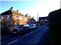
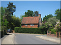
2
Bramley Drive
At junction with Brookside.
Image: © Oast House Archive
Taken: 3 Jun 2010
0.06 miles
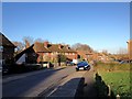
9
The Pest House, Frythe Walk
C16 timber framed Grade II listed former pest house. The chimney is at a very tilted angle.
Image: © Oast House Archive
Taken: 3 Jun 2010
0.12 miles
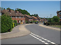
10
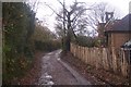
Restricted byway on Freight Lane
Freight Lane leads from Bramley Drive towards Mount Ephraim and Freight House.
Image: © David Anstiss
Taken: 22 Nov 2009
0.13 miles