IMAGES TAKEN NEAR TO
The Common, CRANBROOK, TN17 2AD
Introduction
This page details the photographs taken nearby to The Common, TN17 2AD by members of the Geograph project.
The Geograph project started in 2005 with the aim of publishing, organising and preserving representative images for every square kilometre of Great Britain, Ireland and the Isle of Man.

There are currently over 7.5m images from over14,400 individuals and you can help contribute to the project by visiting https://www.geograph.org.uk
Image Map
Images are licensed for reuse under creativecommons.org/licenses/by-sa/2.0
Notes
- Clicking on the map will re-center to the selected point.
- The higher the marker number, the further away the image location is from the centre of the postcode.
Image Listing (18 Images Found)
Images are licensed for reuse under creativecommons.org/licenses/by-sa/2.0
Image
Details
Distance
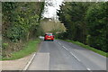
1
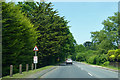
A229 heading north
Towards Staplehurst.
Image: © Robin Webster
Taken: 28 May 2018
0.07 miles
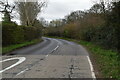
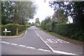
2
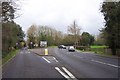
Fork in the road
Left to Sissinghurst, right to Cranbrook.
Image: © Jonathan Billinger
Taken: 13 Dec 2006
0.08 miles
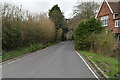
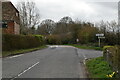
4
The Crossways
On the junction of Frittenden Road (in front) and Common Road (unseen, to the right).
Image: © David Anstiss
Taken: 20 Sep 2009
0.10 miles
8
Frittenden Road, Sissinghurst
This road leads from The Common to Frittenden village.
Image: © David Anstiss
Taken: 20 Sep 2009
0.14 miles
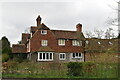
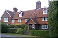
9

Camden Terrace, The Common, Sissinghurst
Image: © Chris Whippet
Taken: 1 Feb 2016
0.15 miles