IMAGES TAKEN NEAR TO
Lurkins Rise, CRANBROOK, TN17 1ED
Introduction
This page details the photographs taken nearby to Lurkins Rise, TN17 1ED by members of the Geograph project.
The Geograph project started in 2005 with the aim of publishing, organising and preserving representative images for every square kilometre of Great Britain, Ireland and the Isle of Man.

There are currently over 7.5m images from over14,400 individuals and you can help contribute to the project by visiting https://www.geograph.org.uk
Image Map
Images are licensed for reuse under creativecommons.org/licenses/by-sa/2.0
Notes
- Clicking on the map will re-center to the selected point.
- The higher the marker number, the further away the image location is from the centre of the postcode.
Image Listing (112 Images Found)
Images are licensed for reuse under creativecommons.org/licenses/by-sa/2.0
Image
Details
Distance
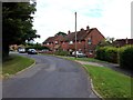
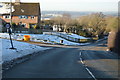
4
The South Downs from Clayhill, Goudhurst
Image: © David Howard
Taken: 28 Apr 2013
0.05 miles
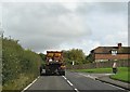
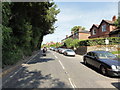
6
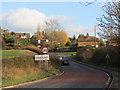
Clayhill
A262 entering Goudhurst.
Image: © Oast House Archive
Taken: 7 Dec 2011
0.05 miles
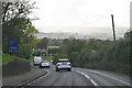
7
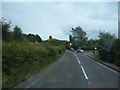
A262, Goudhurst, Clay Hill Road
Goudhurst is a village in Kent on the Weald, about 12 miles (19 km) south of Maidstone. It stands on a crossroads, where there is a large village pond.
Image: © Raimund Zozmann
Taken: 18 Jul 2009
0.06 miles
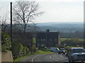
8
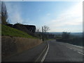
Clayhill, Goudhurst
Looking across to the South Downs
Image: © David Howard
Taken: 28 Apr 2013
0.06 miles
9
Goudhurst
Goudhurst, Clay Hill, A262.
Image: © Helmut Zozmann
Taken: 31 Jul 2011
0.08 miles
10

Tour De France 2007, High Street, Goudhurst
Coming up the hill into Goudhurst, the Tour De France (Tour De Kent) stage 1 passes through.
Image: © Oast House Archive
Taken: 8 Jul 2007
0.09 miles