IMAGES TAKEN NEAR TO
The Copse, WESTERHAM, TN16 2DB
Introduction
This page details the photographs taken nearby to The Copse, TN16 2DB by members of the Geograph project.
The Geograph project started in 2005 with the aim of publishing, organising and preserving representative images for every square kilometre of Great Britain, Ireland and the Isle of Man.

There are currently over 7.5m images from over14,400 individuals and you can help contribute to the project by visiting https://www.geograph.org.uk
Image Map
Images are licensed for reuse under creativecommons.org/licenses/by-sa/2.0
Notes
- Clicking on the map will re-center to the selected point.
- The higher the marker number, the further away the image location is from the centre of the postcode.
Image Listing (46 Images Found)
Images are licensed for reuse under creativecommons.org/licenses/by-sa/2.0
Image
Details
Distance
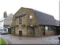
1
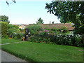
Rose Cottage, Tatsfield
The cottage garden rather dominates the cottage.
Image: © Robin Webster
Taken: 31 Jul 2011
0.08 miles
2
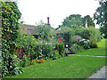
Rose Cottage, Tatsfield
The cottage garden rather dominates the cottage.
Image: © Robin Webster
Taken: 31 Jul 2011
0.08 miles
3
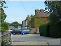
Houses on Grove Road, Tatsfield
Looking from the path through from the northern extremity of Westmore Green.
Image: © Robin Webster
Taken: 31 Jul 2011
0.11 miles
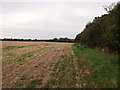
5
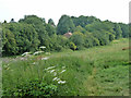
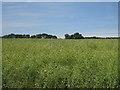
Footpath from Lusted Hall Lane to Goatsfield Road, Tatsfield
Not very clear across the field, it leaves the field about in line with the house.
Image: © Robin Webster
Taken: 31 Jul 2011
0.12 miles
6
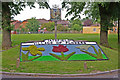
Tatsfield floral sign
Tatsfield is a regular winner of the large village section of the South East in Bloom contest, having won 5 times since 2000, and having been runner up in the "Champion of champions" category in 2007. This floral village sign is part of the 2008 entry, greeting people coming into the village from the south.
The metal village sign refers to the English Place Name Society's suggested derivation of the village name: ‘a field or open land belonging to one Tatol’.
Image: © Ian Capper
Taken: 9 Jun 2008
0.14 miles
7
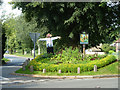
Tatsfield village sign and scarecrow
In a corner of Westmore Green.
Image: © Robin Webster
Taken: 31 Jul 2011
0.14 miles
9
Not the bridleway to Beddlestead!
I thought the bridleway to Beddlestead from Lusted Hall Lane, went beside this hedge. But at the end of the field, could not find a gap in the hedge.
So had to re-trace my steps back to the lane.
The bridleway was actually following the hedge in the background, heading left.
Image: © David Anstiss
Taken: 9 Oct 2011
0.15 miles