IMAGES TAKEN NEAR TO
London Road, WESTERHAM, TN16 1GR
Introduction
This page details the photographs taken nearby to London Road, TN16 1GR by members of the Geograph project.
The Geograph project started in 2005 with the aim of publishing, organising and preserving representative images for every square kilometre of Great Britain, Ireland and the Isle of Man.

There are currently over 7.5m images from over14,400 individuals and you can help contribute to the project by visiting https://www.geograph.org.uk
Image Map
Images are licensed for reuse under creativecommons.org/licenses/by-sa/2.0
Notes
- Clicking on the map will re-center to the selected point.
- The higher the marker number, the further away the image location is from the centre of the postcode.
Image Listing (37 Images Found)
Images are licensed for reuse under creativecommons.org/licenses/by-sa/2.0
Image
Details
Distance
1
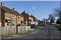
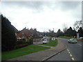
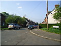
London Road
1950s housing on the northern edge of Westerham.
Image: © Ian Capper
Taken: 25 Apr 2013
0.05 miles
2
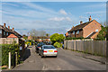
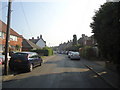
Hartley Road
1950s housing on the northern edge of Westerham.
Image: © Ian Capper
Taken: 24 Apr 2014
0.09 miles
3
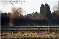
Court Lodge Oast, London Road, Westerham, Kent
Image: © Oast House Archive
Taken: 29 Dec 2008
0.09 miles
8
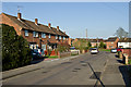
Hartley Road
1950s housing on the northern edge of Westerham.
Image: © Ian Capper
Taken: 25 Apr 2013
0.12 miles
10
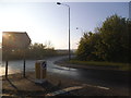
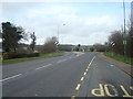
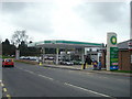
Roundabout at the junction of Beggar's Lane and London Road
The bridge over the M25 can be seen on the right
Image: © David Howard
Taken: 20 Apr 2014
0.16 miles