IMAGES TAKEN NEAR TO
The Hurst, SEVENOAKS, TN15 8SN
Introduction
This page details the photographs taken nearby to The Hurst, TN15 8SN by members of the Geograph project.
The Geograph project started in 2005 with the aim of publishing, organising and preserving representative images for every square kilometre of Great Britain, Ireland and the Isle of Man.

There are currently over 7.5m images from over14,400 individuals and you can help contribute to the project by visiting https://www.geograph.org.uk
Image Map
Images are licensed for reuse under creativecommons.org/licenses/by-sa/2.0
Notes
- Clicking on the map will re-center to the selected point.
- The higher the marker number, the further away the image location is from the centre of the postcode.
Image Listing (59 Images Found)
Images are licensed for reuse under creativecommons.org/licenses/by-sa/2.0
Image
Details
Distance
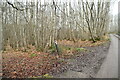
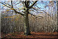
1
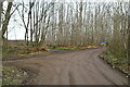
The Hurst
Road alongside Hurst Wood near Plaxtol
Image: © Richard Croft
Taken: 25 Jul 2009
0.09 miles
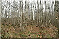
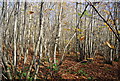
3
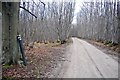
Footpath junction on Weald Way
Ahead the main track swings right and the Weald Way path continues NNE. just before that at the point of this shot is a footpath junction. The way mark post has been broken off but someone has carefully (and accurately) aligned it and leaned it against the tree.
Image: © Trevor Harris
Taken: 4 Feb 2012
0.11 miles