IMAGES TAKEN NEAR TO
Grange Road, SEVENOAKS, TN15 8NF
Introduction
This page details the photographs taken nearby to Grange Road, TN15 8NF by members of the Geograph project.
The Geograph project started in 2005 with the aim of publishing, organising and preserving representative images for every square kilometre of Great Britain, Ireland and the Isle of Man.

There are currently over 7.5m images from over14,400 individuals and you can help contribute to the project by visiting https://www.geograph.org.uk
Image Map
Images are licensed for reuse under creativecommons.org/licenses/by-sa/2.0
Notes
- Clicking on the map will re-center to the selected point.
- The higher the marker number, the further away the image location is from the centre of the postcode.
Image Listing (68 Images Found)
Images are licensed for reuse under creativecommons.org/licenses/by-sa/2.0
Image
Details
Distance
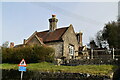
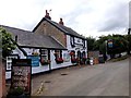
1
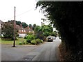
The Blue Anchor, Grange Road, Platt
Image: © Oast House Archive
Taken: 13 Mar 2010
0.02 miles
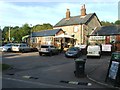
3
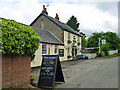
The Blue Anchor, Platt
A Greene King pub.
Image: © Robin Webster
Taken: 4 Jun 2012
0.03 miles
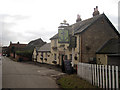
5
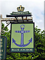
Inn sign, Blue Anchor
On Grange Road, Platt.
Image: © Robin Webster
Taken: 4 Jun 2012
0.03 miles
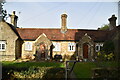
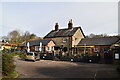
7
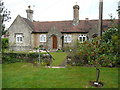
The Captain's Walk, Platt
This is a row of four almshouses, listed Grade II. The listing details state that it was built c. 1850 in Tudor-Revival style. They are managed by the Betenson Trust.
Image: © Humphrey Bolton
Taken: 12 Sep 2015
0.03 miles