IMAGES TAKEN NEAR TO
Windmill Hill, SEVENOAKS, TN15 7ST
Introduction
This page details the photographs taken nearby to Windmill Hill, TN15 7ST by members of the Geograph project.
The Geograph project started in 2005 with the aim of publishing, organising and preserving representative images for every square kilometre of Great Britain, Ireland and the Isle of Man.

There are currently over 7.5m images from over14,400 individuals and you can help contribute to the project by visiting https://www.geograph.org.uk
Image Map
Images are licensed for reuse under creativecommons.org/licenses/by-sa/2.0
Notes
- Clicking on the map will re-center to the selected point.
- The higher the marker number, the further away the image location is from the centre of the postcode.
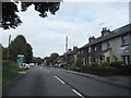
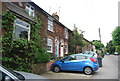
Image Listing (49 Images Found)
Images are licensed for reuse under creativecommons.org/licenses/by-sa/2.0
Image
Details
Distance
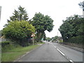
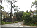
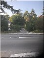
2
Huntsman Lane at the junction of the A25
Compare and contrast with my previous visit http://www.geograph.org.uk/photo/4963673
Image: © David Howard
Taken: 12 Jun 2016
0.02 miles
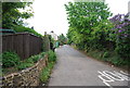
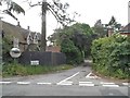
7
Huntsman Lane
Linking Maidstone Road to London Road, Wrotham Heath.
Image: © Anthony Vosper
Taken: 20 Sep 2020
0.02 miles
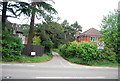
8
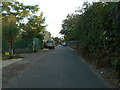
Windmill Lane, railway bridge
The track runs through a cutting at this point. The windmill is no longer in existence.
Image: © Anthony Vosper
Taken: 20 Sep 2020
0.03 miles