IMAGES TAKEN NEAR TO
Ford Lane, SEVENOAKS, TN15 7SD
Introduction
This page details the photographs taken nearby to Ford Lane, TN15 7SD by members of the Geograph project.
The Geograph project started in 2005 with the aim of publishing, organising and preserving representative images for every square kilometre of Great Britain, Ireland and the Isle of Man.

There are currently over 7.5m images from over14,400 individuals and you can help contribute to the project by visiting https://www.geograph.org.uk
Image Map
Images are licensed for reuse under creativecommons.org/licenses/by-sa/2.0
Notes
- Clicking on the map will re-center to the selected point.
- The higher the marker number, the further away the image location is from the centre of the postcode.
Image Listing (32 Images Found)
Images are licensed for reuse under creativecommons.org/licenses/by-sa/2.0
Image
Details
Distance
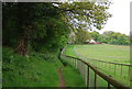
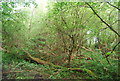
4
The Wealdway crosses Ford Lane
The long distance footpath crosses road from A20 London Road,Wrotham Heath heading to St Vincents Lane.
Image: © David Anstiss
Taken: 17 Feb 2009
0.03 miles
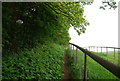
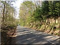
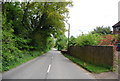
8
Track off Ford Lane
To the left is the southern boundary of Ford Place. Millpond Cottage is just behind where I am standing, on the other side of Ford Lane.
Image: © Marathon
Taken: 10 Apr 2016
0.10 miles