IMAGES TAKEN NEAR TO
Gravesend Road, SEVENOAKS, TN15 7QD
Introduction
This page details the photographs taken nearby to Gravesend Road, TN15 7QD by members of the Geograph project.
The Geograph project started in 2005 with the aim of publishing, organising and preserving representative images for every square kilometre of Great Britain, Ireland and the Isle of Man.

There are currently over 7.5m images from over14,400 individuals and you can help contribute to the project by visiting https://www.geograph.org.uk
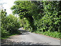
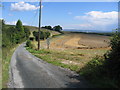
Image Map
Images are licensed for reuse under creativecommons.org/licenses/by-sa/2.0
Notes
- Clicking on the map will re-center to the selected point.
- The higher the marker number, the further away the image location is from the centre of the postcode.
Image Listing (29 Images Found)
Images are licensed for reuse under creativecommons.org/licenses/by-sa/2.0
Image
Details
Distance
2
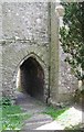
St George, Wrotham, Kent - Passage under tower
Image: © John Salmon
Taken: 23 Jun 2001
0.10 miles
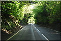
6
Wrotham Water, National Trust
A lovely road to stroll down on a sunny afternoon.
Image: © Pip Rolls
Taken: 28 Aug 2006
0.14 miles
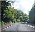
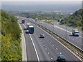
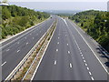
7

M20
Looking along the M20 from the A20 overbridge near Wrotham, with the on sliproad at junction 2 on the right.
Image: © Ian Capper
Taken: 17 Feb 2022
0.16 miles
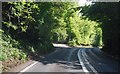
10
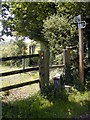
Where the North Downs Way rejoins the road
Image: © Chris Gunns
Taken: 8 Jun 2007
0.16 miles