IMAGES TAKEN NEAR TO
Childsbridge Way, SEVENOAKS, TN15 0DG
Introduction
This page details the photographs taken nearby to Childsbridge Way, TN15 0DG by members of the Geograph project.
The Geograph project started in 2005 with the aim of publishing, organising and preserving representative images for every square kilometre of Great Britain, Ireland and the Isle of Man.

There are currently over 7.5m images from over14,400 individuals and you can help contribute to the project by visiting https://www.geograph.org.uk
Image Map
Images are licensed for reuse under creativecommons.org/licenses/by-sa/2.0
Notes
- Clicking on the map will re-center to the selected point.
- The higher the marker number, the further away the image location is from the centre of the postcode.
Image Listing (48 Images Found)
Images are licensed for reuse under creativecommons.org/licenses/by-sa/2.0
Image
Details
Distance
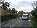
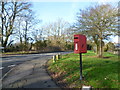
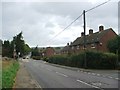
2
Road works on Childsbridge Lane
Refreshingly no lights on this short obstruction.
Image: © Robin Webster
Taken: 6 Jan 2012
0.08 miles
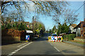
7
Childsbridge Lane, Seal
This is on the northern edge of Seal, seen from the junction with Bentley's Meadow. The road ahead leads to Kemsing.
Image: © Marathon
Taken: 24 Jan 2015
0.14 miles
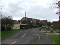
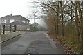
9
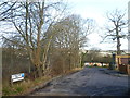
Ragstones, Seal
This is on the northern edge of Seal, looking towards the junction with Childsbridge Lane. The road changes to a footpath just behind where I am standing and leads to Wildernesse.
Image: © Marathon
Taken: 24 Jan 2015
0.14 miles