IMAGES TAKEN NEAR TO
Chipstead Park, SEVENOAKS, TN13 2SL
Introduction
This page details the photographs taken nearby to Chipstead Park, TN13 2SL by members of the Geograph project.
The Geograph project started in 2005 with the aim of publishing, organising and preserving representative images for every square kilometre of Great Britain, Ireland and the Isle of Man.

There are currently over 7.5m images from over14,400 individuals and you can help contribute to the project by visiting https://www.geograph.org.uk
Image Map (Loading...)


Getting Data...Please wait
Leaflet Map data © OpenStreetMap
Images are licensed for reuse under creativecommons.org/licenses/by-sa/2.0
Notes
- Clicking on the map will re-center to the selected point.
- The higher the marker number, the further away the image location is from the centre of the postcode.
Image Listing (47 Images Found)
Images are licensed for reuse under creativecommons.org/licenses/by-sa/2.0
Image
Details
Distance
7
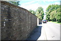
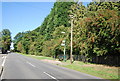
Stone built wall, chipstead Lane
Built using the local Greensand.
Image: © N Chadwick
Taken: 26 Jun 2011
0.11 miles
8

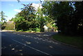
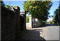
White Lodge
Grade II listed. http://www.britishlistedbuildings.co.uk/en-356980-white-lodge-chevening
Image: © N Chadwick
Taken: 26 Jun 2011
0.11 miles
10
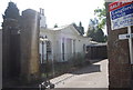
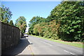
White Lodge, Chipstead Place Gardens
A Grade II listed building http://www.britishlistedbuildings.co.uk/en-356980-white-lodge-chevening
Image: © N Chadwick
Taken: 30 Aug 2010
0.12 miles