IMAGES TAKEN NEAR TO
The Rise, SEVENOAKS, TN13 1RN
Introduction
This page details the photographs taken nearby to The Rise, TN13 1RN by members of the Geograph project.
The Geograph project started in 2005 with the aim of publishing, organising and preserving representative images for every square kilometre of Great Britain, Ireland and the Isle of Man.

There are currently over 7.5m images from over14,400 individuals and you can help contribute to the project by visiting https://www.geograph.org.uk
Image Map
Images are licensed for reuse under creativecommons.org/licenses/by-sa/2.0
Notes
- Clicking on the map will re-center to the selected point.
- The higher the marker number, the further away the image location is from the centre of the postcode.
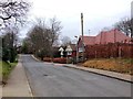
Image Listing (33 Images Found)
Images are licensed for reuse under creativecommons.org/licenses/by-sa/2.0
Image
Details
Distance
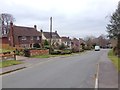
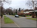
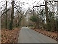
1
The Rise
The road continues to the left at the junction with White Hart Wood and connects Letter Box Lane.
Image: © Oast House Archive
Taken: 13 Apr 2010
0.03 miles
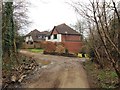
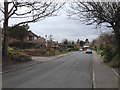
4
Path in Sevenoaks Common
This path leads from Letterbox lane to Gracious Lane. It is one of many paths in the small piece of woodland.
Image: © David Anstiss
Taken: 22 Mar 2015
0.09 miles
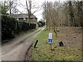
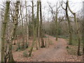
7
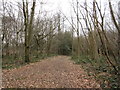
Path in Sevenoaks Common
This wide open path leads from Gracious Lane to Letter box lane.
Image: © David Anstiss
Taken: 22 Mar 2015
0.12 miles