IMAGES TAKEN NEAR TO
South Park, SEVENOAKS, TN13 1EH

Introduction

This page details the photographs taken nearby to South Park, TN13 1EH by members of the Geograph project.

The Geograph project started in 2005 with the aim of publishing, organising and preserving representative images for every square kilometre of Great Britain, Ireland and the Isle of Man.

There are currently over 7.5m images from over14,400 individuals and you can help contribute to the project by visiting https://www.geograph.org.uk

Image Map


Images are licensed for reuse under creativecommons.org/licenses/by-sa/2.0
Notes
  • Clicking on the map will re-center to the selected point.
  • The higher the marker number, the further away the image location is from the centre of the postcode.

Image Listing (296 Images Found)

Images are licensed for reuse under creativecommons.org/licenses/by-sa/2.0
  • ...
Image
Details
Distance
1
Old Boundary Marker
Parish Boundary Marker against the corner wall of No.1 South Park, southwest of its junction with Crownfields. On the boundary of St Mary Kippington, SEVENOAKS. Inscribed K / St M / D / 1877 / No.1. Milestone Society National ID: KE_SEVSTM01pb
Image: © M Barrow Taken: 26 Jan 2019
0.00 miles
2
South Park, Sevenoaks
In a burst of sunshine following rain, this shows the junction with Crownfields, leading off to the left.
Image: © Stephen McKay Taken: 22 Nov 2016
0.01 miles
3
St Thomas Roman Catholic Primary School
On South Park (road).
Image: © David Anstiss Taken: 22 Mar 2015
0.03 miles
4
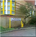
South Park Medical Practice
Image: © Alex McGregor Taken: 21 Feb 2013
0.03 miles
5
The Church of Christ Scientist
On South Park road.
Image: © David Anstiss Taken: 16 Aug 2009
0.04 miles
6
No 29 and 31, Lime Tree Walk
A pair of Grade II listed cottages, part of several listed buildings along the road. In front of the buildings are pollarded lime trees. See http://www.britishlistedbuildings.co.uk/en-439547-lime-tree-cottages-sevenoaks-kent for more details about the buildings.
Image: © David Anstiss Taken: 22 Mar 2015
0.05 miles
7
South Park near Lime Tree Walk
Across the road is St. Thomas' Catholic Primary School.
Image: © DS Pugh Taken: 15 Sep 2021
0.05 miles
8
Lime Tree Walk
A terrace row of Grade II listed cottages on both sides of the road. No.40 is on the far left. See http://www.britishlistedbuildings.co.uk/en-172235-2-40-lime-tree-walk-see-details-for-furt for more details about the terrace.
Image: © David Anstiss Taken: 22 Mar 2015
0.05 miles
9
Towards South Park Medical Practice
Looking along South Park in Sevenoaks.
Image: © DS Pugh Taken: 15 Sep 2021
0.05 miles
10
Lime Tree Walk
A row of Grade II listed terraced houses. There are terraces on both sides of the road. On the left hand side are pollarded lime trees. See http://www.britishlistedbuildings.co.uk/en-172235-2-40-lime-tree-walk-see-details-for-furt for more details about the terraced housing.
Image: © David Anstiss Taken: 22 Mar 2015
0.06 miles
  • ...