IMAGES TAKEN NEAR TO
Willard Place, TONBRIDGE, TN12 8AQ
Introduction
This page details the photographs taken nearby to Willard Place, TN12 8AQ by members of the Geograph project.
The Geograph project started in 2005 with the aim of publishing, organising and preserving representative images for every square kilometre of Great Britain, Ireland and the Isle of Man.

There are currently over 7.5m images from over14,400 individuals and you can help contribute to the project by visiting https://www.geograph.org.uk
Image Map
Images are licensed for reuse under creativecommons.org/licenses/by-sa/2.0
Notes
- Clicking on the map will re-center to the selected point.
- The higher the marker number, the further away the image location is from the centre of the postcode.
Image Listing (87 Images Found)
Images are licensed for reuse under creativecommons.org/licenses/by-sa/2.0
Image
Details
Distance
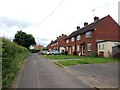
1
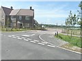
Willard Close
This cul-de-sac lies off Gibbet Lane.
Image: © John Baker
Taken: 30 Jun 2013
0.03 miles
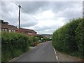
2
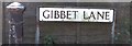
Gibbet Lane, Horsmonden, once the site of many a grisly execution
In common with other Wealden villages, 18th century Horsmonden was in smuggling country and, being astride the Tonbridge road, was also the haunt of highwaymen. The most notorious smugglers of that time were the Hawkhurst Gang http://en.wikipedia.org/wiki/Hawkhurst_Gang who used to terrorise the locality. It is said that the cellars of Image, and secret passages leading from them, were used for their contraband. In 1747, seven members of the gang, including its leader Richard Kingsmill, were cornered nearby after a shoot out with militia. They were duly hanged here and, as a warning to the parish, the bodies of two of them, Gore and Fairall by name, were displayed in Horsmonden chained up to a post in Gibbet Lane, perhaps this one - full article about the village history http://books.google.co.uk/books?id=2_ZstVBZSfIC&lpg=PA1&pg=PA99#v=onepage&q=&f=true
Also see Gallery at: http://www.geograph.org.uk/gallery/the_history_of_horsmonden_8738
Image: © D Gore
Taken: Unknown
0.06 miles
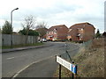
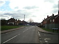
3
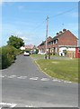
Gibbet Lane
In the distance is a house situated in Willard Close. The map doesn't give this section of the road a name, but what it refers to as Gibbet Lane is a narrow thoroughfare off this road, which runs between Furnace Lane and Maidstone Road.
Image: © John Baker
Taken: 30 Jun 2013
0.07 miles
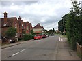
10
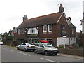
The Highwayman Public House, Horsmonden
On B2162 Maidstone Road.
Image: © David Anstiss
Taken: 3 Jun 2009
0.12 miles