IMAGES TAKEN NEAR TO
Dumbrell Drive, TONBRIDGE, TN12 6FR
Introduction
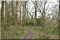
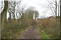
This page details the photographs taken nearby to Dumbrell Drive, TN12 6FR by members of the Geograph project.
The Geograph project started in 2005 with the aim of publishing, organising and preserving representative images for every square kilometre of Great Britain, Ireland and the Isle of Man.

There are currently over 7.5m images from over14,400 individuals and you can help contribute to the project by visiting https://www.geograph.org.uk
Image Map
Images are licensed for reuse under creativecommons.org/licenses/by-sa/2.0
Notes
- Clicking on the map will re-center to the selected point.
- The higher the marker number, the further away the image location is from the centre of the postcode.
Image Listing (82 Images Found)
Images are licensed for reuse under creativecommons.org/licenses/by-sa/2.0
Image
Details
Distance

9
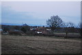
Pond, Mascall's Court
Set in orchards, by the road.
Image: © N Chadwick
Taken: 5 Feb 2011
0.15 miles
10
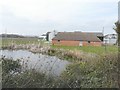
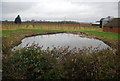
Pond and outbuildings, Mascalls Court Farm
Seen from the verge of Mascall's Court Road. Although Mascalls is spelt with an apostrophe 's' on the map, the name-plate of the farm is spelt without.
Image: © John Baker
Taken: 21 Apr 2013
0.15 miles