IMAGES TAKEN NEAR TO
Chapel Lane, TONBRIDGE, TN12 0AL
Introduction
This page details the photographs taken nearby to Chapel Lane, TN12 0AL by members of the Geograph project.
The Geograph project started in 2005 with the aim of publishing, organising and preserving representative images for every square kilometre of Great Britain, Ireland and the Isle of Man.

There are currently over 7.5m images from over14,400 individuals and you can help contribute to the project by visiting https://www.geograph.org.uk
Image Map (Loading...)


Getting Data...Please wait
Leaflet Map data © OpenStreetMap
Images are licensed for reuse under creativecommons.org/licenses/by-sa/2.0
Notes
- Clicking on the map will re-center to the selected point.
- The higher the marker number, the further away the image location is from the centre of the postcode.
Image Listing (203 Images Found)
Images are licensed for reuse under creativecommons.org/licenses/by-sa/2.0
Image
Details
Distance
1
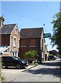
Staplehurst: Providence Strict Baptist Chapel
Tucked away down Chapel Lane, well away from the High Street.
Could this be the only weather-boarded place of worship in Kent? I can imagine something similar might be found in the Reculver area - or (more likely) in one of the villages on the Essex marshes.
Image: © Stefan Czapski
Taken: 8 Jul 2018
0.03 miles
2
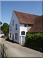
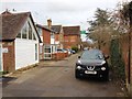
Staplehurst: former wheelwright's shop, Chapel Lane
The pierced sign reads:
VICTORIA WORKS
JOHN HARRIS AND SONS
WHEELWRIGHTS
UNDERTAKERS
Image: © Stefan Czapski
Taken: 8 Jul 2018
0.03 miles
3
Providence Street Baptist Chapel
On Chapel Lane, Staplehurst.
Image: © David Anstiss
Taken: 19 Apr 2009
0.04 miles
6
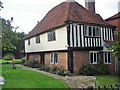
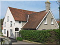
Bly Court Manor, Staplehurst
A compact south-facing 16th century manor house in the centre of Staplehurst village, 50 yards to the east of the A229. A small lush garden surrounds the large goldfish pond especially attractive to moorhens... The traditional half- timbered front elevation was covered by concrete skim early in the 20th century.
Image: © John Fielding
Taken: 30 Oct 2005
0.05 miles
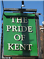
10
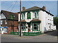
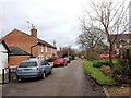
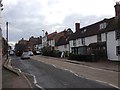
The Pride of Kent Public House, Staplehurst
On junction of A229 High Street (in front) and Chapel Lane (on right).
Image: © David Anstiss
Taken: 19 Apr 2009
0.06 miles