IMAGES TAKEN NEAR TO
Gaza Trading Estate, Scabharbour Road, TONBRIDGE, TN11 8PL
Introduction
This page details the photographs taken nearby to Gaza Trading Estate, Scabharbour Road, TN11 8PL by members of the Geograph project.
The Geograph project started in 2005 with the aim of publishing, organising and preserving representative images for every square kilometre of Great Britain, Ireland and the Isle of Man.

There are currently over 7.5m images from over14,400 individuals and you can help contribute to the project by visiting https://www.geograph.org.uk
Image Map
Images are licensed for reuse under creativecommons.org/licenses/by-sa/2.0
Notes
- Clicking on the map will re-center to the selected point.
- The higher the marker number, the further away the image location is from the centre of the postcode.
Image Listing (20 Images Found)
Images are licensed for reuse under creativecommons.org/licenses/by-sa/2.0
Image
Details
Distance
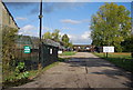
2
Gaza Trading Estate
This used to be called The Gaza Barracks and during the 2nd World war was an army barracks. The Gaza Trading Estate is now split into a variety of units.
Image: © Jean Barrow
Taken: 21 Apr 2006
0.04 miles
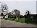
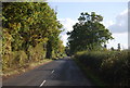
3
Driveway to Eastwood Farm, Scabharbour Rd
Image: © N Chadwick
Taken: 10 Oct 2009
0.06 miles
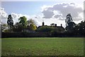

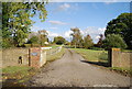
9
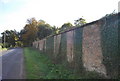
Wall surrounding Southwood, Scabharbour Rd
Image: © N Chadwick
Taken: 10 Oct 2009
0.16 miles