IMAGES TAKEN NEAR TO
Hayesden Lane, TONBRIDGE, TN11 8AB
Introduction
This page details the photographs taken nearby to Hayesden Lane, TN11 8AB by members of the Geograph project.
The Geograph project started in 2005 with the aim of publishing, organising and preserving representative images for every square kilometre of Great Britain, Ireland and the Isle of Man.

There are currently over 7.5m images from over14,400 individuals and you can help contribute to the project by visiting https://www.geograph.org.uk
Image Map
Images are licensed for reuse under creativecommons.org/licenses/by-sa/2.0
Notes
- Clicking on the map will re-center to the selected point.
- The higher the marker number, the further away the image location is from the centre of the postcode.
Image Listing (18 Images Found)
Images are licensed for reuse under creativecommons.org/licenses/by-sa/2.0
Image
Details
Distance
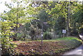
1
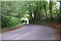
Upper Haysden Lane passes through Judd's Wood
Image: © N Chadwick
Taken: 18 Jun 2008
0.04 miles
2
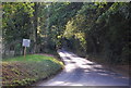
Upper Haysden Lane climbs the Bidborough Ridge
Image: © N Chadwick
Taken: 2 Oct 2009
0.06 miles
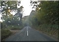
3
Upper Haysden Lane in the trees
A very typical scene around this part of Kent
Image: © N Chadwick
Taken: 18 Jun 2008
0.07 miles
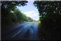
4
Hayesden Road, Upper Hayesden
I remember passing through the smoke from a bonfire somewhere in the area, and it looks like that was probably it ahead.
Image: © David Howard
Taken: 10 Oct 2015
0.08 miles
5
Road Sign, junction of Ensfield Rd & Upper Haysden Lane
Image: © N Chadwick
Taken: 2 Oct 2009
0.11 miles
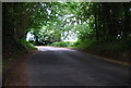
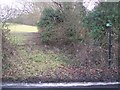
6
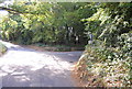
Junction of Upper Haysden Lane & Ensfield Rd
Image: © N Chadwick
Taken: 2 Oct 2009
0.11 miles
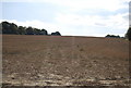
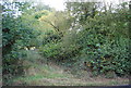
9
Footpath to Judd's Wood
This footpath leads from Haysden Lane to the wood and then onto Gate Farm Road
Image: © David Anstiss
Taken: 31 Jan 2010
0.14 miles
10
Footpath signposted off Upper Haysden Lane
Image: © N Chadwick
Taken: 2 Oct 2009
0.15 miles