IMAGES TAKEN NEAR TO
Cranford Road, TONBRIDGE, TN10 4HL
Introduction
This page details the photographs taken nearby to Cranford Road, TN10 4HL by members of the Geograph project.
The Geograph project started in 2005 with the aim of publishing, organising and preserving representative images for every square kilometre of Great Britain, Ireland and the Isle of Man.

There are currently over 7.5m images from over14,400 individuals and you can help contribute to the project by visiting https://www.geograph.org.uk
Image Map
Images are licensed for reuse under creativecommons.org/licenses/by-sa/2.0
Notes
- Clicking on the map will re-center to the selected point.
- The higher the marker number, the further away the image location is from the centre of the postcode.
Image Listing (18 Images Found)
Images are licensed for reuse under creativecommons.org/licenses/by-sa/2.0
Image
Details
Distance
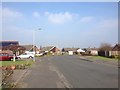
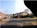

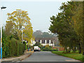
5
Hadlow Road, Tonbridge
This is the far NW corner of the town
Image: © David Howard
Taken: 22 May 2016
0.14 miles
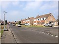
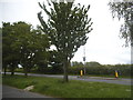
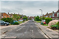
6
Hadlow Road East
This is the residential road paralleling the main A26 road to the right.
Image: © Robin Webster
Taken: 24 Oct 2012
0.15 miles
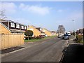
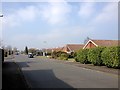
8
Framley Road
c.1960s housing in the area between Hadlow Road and Higham Lane.
Image: © Ian Capper
Taken: 17 Jun 2021
0.17 miles