IMAGES TAKEN NEAR TO
Cherwell Close, TONBRIDGE, TN10 3TH
Introduction
This page details the photographs taken nearby to Cherwell Close, TN10 3TH by members of the Geograph project.
The Geograph project started in 2005 with the aim of publishing, organising and preserving representative images for every square kilometre of Great Britain, Ireland and the Isle of Man.

There are currently over 7.5m images from over14,400 individuals and you can help contribute to the project by visiting https://www.geograph.org.uk
Image Map
Images are licensed for reuse under creativecommons.org/licenses/by-sa/2.0
Notes
- Clicking on the map will re-center to the selected point.
- The higher the marker number, the further away the image location is from the centre of the postcode.
Image Listing (126 Images Found)
Images are licensed for reuse under creativecommons.org/licenses/by-sa/2.0
Image
Details
Distance
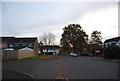
1
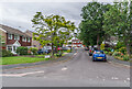
Cherwell Close
c.1970s cul-de-sac off Long Mead Way.
Image: © Ian Capper
Taken: 30 Jun 2021
0.02 miles
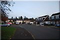
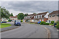
2
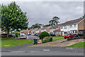
Cherwell Close
c.1970s cul-de-sac off Long Mead Way.
Image: © Ian Capper
Taken: 30 Jun 2021
0.03 miles
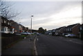
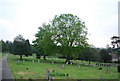
7
Long Mead Way
c.1970s housing on land west of Tonbridge Cemetery.
Image: © Ian Capper
Taken: 30 Jun 2021
0.05 miles
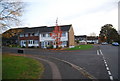
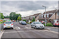
9
Long Mead Way
c.1970s housing on land west of Tonbridge Cemetery.
Image: © Ian Capper
Taken: 30 Jun 2021
0.06 miles