IMAGES TAKEN NEAR TO
Sharpland, MARKET DRAYTON, TF9 4RN
Introduction
This page details the photographs taken nearby to Sharpland, TF9 4RN by members of the Geograph project.
The Geograph project started in 2005 with the aim of publishing, organising and preserving representative images for every square kilometre of Great Britain, Ireland and the Isle of Man.

There are currently over 7.5m images from over14,400 individuals and you can help contribute to the project by visiting https://www.geograph.org.uk
Image Map
Images are licensed for reuse under creativecommons.org/licenses/by-sa/2.0
Notes
- Clicking on the map will re-center to the selected point.
- The higher the marker number, the further away the image location is from the centre of the postcode.
Image Listing (13 Images Found)
Images are licensed for reuse under creativecommons.org/licenses/by-sa/2.0
Image
Details
Distance
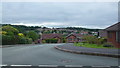
1
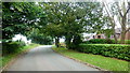
Mucklestone Wood Lane, 1
The northern boundary of the Loggerheads housing estates, seen to the right.
Image: © Jonathan Billinger
Taken: 6 Sep 2016
0.12 miles
2
Mucklestone Wood Lane, 2
Looking west by the entrance to White House Farm.
Image: © Jonathan Billinger
Taken: 6 Sep 2016
0.13 miles
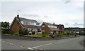
3
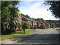
Loggerheads: Brookfield
Brookfield is one of the modern housing estate roads in Loggerfields.
Image: © Nigel Cox
Taken: 15 Jun 2007
0.14 miles
4
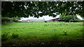
White House Farm
To the north of Mucklestone Wood Lane, the northern boundary of the Loggerheads housing estates.
Image: © Jonathan Billinger
Taken: 6 Sep 2016
0.14 miles
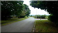
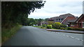
5
Badger Brow Road
A glimpse at the housing estates of Loggerheads from Mucklestone Wood Lane.
Image: © Jonathan Billinger
Taken: 6 Sep 2016
0.14 miles
7
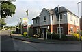
Mucklestone Road, Loggerheads
Leighton View has replaced a field in recent years. A similar development is beginning on the south side of the village here. https://www.geograph.org.uk/photo/7204794
Image: © David Howard
Taken: 19 Jun 2022
0.18 miles
8
Mucklestone Wood Lane
The northern boundary of the Loggerheads housing estates, seen to the right.
Image: © Jonathan Billinger
Taken: 6 Sep 2016
0.18 miles
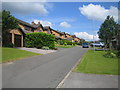
9
Loggerheads: Chestnut Road
Detached houses in the more recent housing estate in Chestnut Road.
Image: © Nigel Cox
Taken: 15 Jun 2007
0.19 miles
10
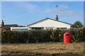
Bungalow on Mucklestone Road, Loggerheads
Image: © David Howard
Taken: 19 Jun 2022
0.20 miles