
IMAGES TAKEN NEAR TO
Shavington Park, MARKET DRAYTON, TF9 3TB
Introduction
This page details the photographs taken nearby to TF9 3TB by members of the Geograph project.
The Geograph project started in 2005 with the aim of publishing, organising and preserving representative images for every square kilometre of Great Britain, Ireland and the Isle of Man.

There are currently over 7.5m images from over14,400 individuals and you can help contribute to the project by visiting https://www.geograph.org.uk
Image Map
Images are licensed for reuse under creativecommons.org/licenses/by-sa/2.0
Notes
- Clicking on the map will re-center to the selected point.
- The higher the marker number, the further away the image location is from the centre of the postcode.
Image Listing (7 Images Found)
Images are licensed for reuse under creativecommons.org/licenses/by-sa/2.0
Image
Details
Distance
1
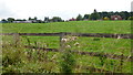
View towards Shavington Home Farm
Thistle seed heads marking the time of year.
Image: © Jonathan Billinger
Taken: 9 Sep 2015
0.09 miles
2
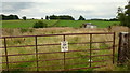
Game rearing facilities?
Whatever it is it's in Shropshire with the pasture land of South Cheshire rising beyond.
Image: © Jonathan Billinger
Taken: 9 Sep 2015
0.17 miles
3
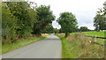
Lane by Shavington Park
The Shavington Park estate is mainly to the right.
Image: © Jonathan Billinger
Taken: 9 Sep 2015
0.18 miles
4
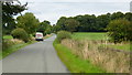
Shropshire Cheshire border
Looking north towards Cheshire; the van is parked at the point where the road surface changes.
Image: © Jonathan Billinger
Taken: 9 Sep 2015
0.18 miles
5
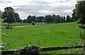
Parkland near Adderley (2)
Shavington was pulled down in 1959, but an extensive parkland survives, much of it now farmed, with a characteristically undulating landscape and many fine, mature trees. In the late C18th, both William Emes and Humphry Repton submitted schemes to landscape the park, but it is not clear whether either were implemented.
Image: © Stephen Richards
Taken: Unknown
0.21 miles
7
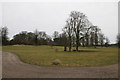
Shavington Park
Ancient Woodland sitting above the Wilkesly Halite, one of the main salt horizons which extends under much of south and east Cheshire and on which the UK chemical industry was founded
Image: © Peter Styles
Taken: 19 Mar 2010
0.24 miles