IMAGES TAKEN NEAR TO
Coalport, TELFORD, TF8 7HA
Introduction
This page details the photographs taken nearby to TF8 7HA by members of the Geograph project.
The Geograph project started in 2005 with the aim of publishing, organising and preserving representative images for every square kilometre of Great Britain, Ireland and the Isle of Man.

There are currently over 7.5m images from over14,400 individuals and you can help contribute to the project by visiting https://www.geograph.org.uk
Image Map
Images are licensed for reuse under creativecommons.org/licenses/by-sa/2.0
Notes
- Clicking on the map will re-center to the selected point.
- The higher the marker number, the further away the image location is from the centre of the postcode.
Image Listing (6 Images Found)
Images are licensed for reuse under creativecommons.org/licenses/by-sa/2.0
Image
Details
Distance
2
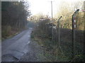
Route of the dismantled railway
The roadway is laid over the route of railway line that ran from Bridgnorth to Shrewsbury. Now part of the Severn Way long distance footpath it continues as far as the power station just west of Ironbridge. The place seems to be almost always in shade due to the steep & high bank to the south and south-west. This section of path is not particularly nice as it passes the local sewage works which can at times have a presence all of their own.
Image: © Row17
Taken: 10 Feb 2008
0.04 miles
3

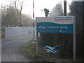
River Severn, Severn Trent sewage treatment works bridge
Considered to be the seventy first bridge from the source. Built in the sixties serving Telford New Town
Image: © kevin skidmore
Taken: 21 Mar 2009
0.07 miles
4
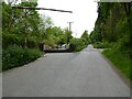
Entrance to an industrial site
Entrance to an industrial site off the former Kidderminster to Shrewsbury railway.
Image: © Philip Halling
Taken: 2 Jun 2021
0.12 miles
5
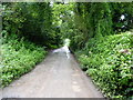
Dismantled railway in The Gorge
The route of the old Buildwas to Bridgnorth railway line, long closed, and although it's not yet finalised, it's hoped that this will become a section of Route 45 of the National Cycle Network.
Image: © Richard Law
Taken: 24 Aug 2010
0.14 miles