
IMAGES TAKEN NEAR TO
Woodcroft, TELFORD, TF7 5NE
Introduction
This page details the photographs taken nearby to Woodcroft, TF7 5NE by members of the Geograph project.
The Geograph project started in 2005 with the aim of publishing, organising and preserving representative images for every square kilometre of Great Britain, Ireland and the Isle of Man.

There are currently over 7.5m images from over14,400 individuals and you can help contribute to the project by visiting https://www.geograph.org.uk
Image Map
Images are licensed for reuse under creativecommons.org/licenses/by-sa/2.0
Notes
- Clicking on the map will re-center to the selected point.
- The higher the marker number, the further away the image location is from the centre of the postcode.
Image Listing (11 Images Found)
Images are licensed for reuse under creativecommons.org/licenses/by-sa/2.0
Image
Details
Distance
1
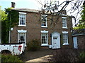
Yew Tree House, Madeley
Yew Tree House dates to the first half of the 19th century, and was Grade II listed https://britishlistedbuildings.co.uk/101208824-yew-tree-house-madeley#.XOq2t4hKjcs & https://historicengland.org.uk/listing/the-list/list-entry/1208824 in 1983.
Image: © Richard Law
Taken: 11 May 2019
0.15 miles
2
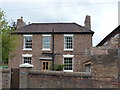
The Hollies, Madeley
Next door to Image, and of a very similar vintage (ie first half 19th century); The Hollies was also Grade II listed https://britishlistedbuildings.co.uk/101033282-the-hollies-madeley#.XUfLdOhKhPY & https://historicengland.org.uk/listing/the-list/list-entry/1033282 in 1983.
Image: © Richard Law
Taken: 16 Jun 2019
0.15 miles
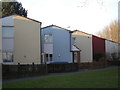
6
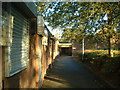
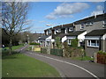
Woodside Community Centre
The usual 60s/70s type of community centre, in among the Woodside estate.
Image: © Steve McShane
Taken: 12 Nov 2005
0.22 miles
7
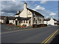
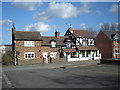
The Park Inn, Madeley
Looking like it's seen busier days, this sits just out of Madeley on Park Street
Image: © Richard Law
Taken: 15 May 2010
0.22 miles
8
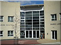
Entrance to the new Park Lane Community Centre, Woodside.
Image: © Row17
Taken: 4 Mar 2008
0.23 miles
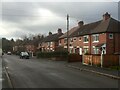
10
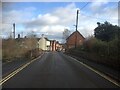
Ironbridge Road, Madeley
There is an undeveloped site on the left which was once a filling station. The whit building which appears to have been a shop is now a tatooists.
Image: © Richard Webb
Taken: 8 Dec 2021
0.23 miles