
IMAGES TAKEN NEAR TO
Coronation Crescent, TELFORD, TF7 5EJ
Introduction
This page details the photographs taken nearby to Coronation Crescent, TF7 5EJ by members of the Geograph project.
The Geograph project started in 2005 with the aim of publishing, organising and preserving representative images for every square kilometre of Great Britain, Ireland and the Isle of Man.

There are currently over 7.5m images from over14,400 individuals and you can help contribute to the project by visiting https://www.geograph.org.uk
Image Map
Images are licensed for reuse under creativecommons.org/licenses/by-sa/2.0
Notes
- Clicking on the map will re-center to the selected point.
- The higher the marker number, the further away the image location is from the centre of the postcode.
Image Listing (69 Images Found)
Images are licensed for reuse under creativecommons.org/licenses/by-sa/2.0
Image
Details
Distance
1
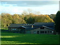
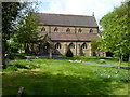
St Mary's RC School, Madeley
Madeley's Catholic Primary school for 5-11 year olds. This view was taken from what used to be the school's playing fields and football pitches. I'm not sure now though who owns the land.
Image: © Steve McShane
Taken: 12 Nov 2005
0.03 miles
2
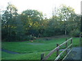
A place to play...
...for the local children of Coronation Crescent.
Image: © Steve McShane
Taken: 12 Nov 2005
0.03 miles
3
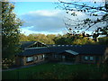
St Mary's 2
Closer shot of the school, where the entrances are.
Image: © Steve McShane
Taken: 12 Nov 2005
0.03 miles
4
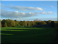
School Fields?
The fields that were formerly part of the school. I guess they still could be, but there are now railings that separate them.
Image: © Steve McShane
Taken: 12 Nov 2005
0.05 miles
7

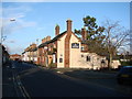
Roman Catholic presbytery, Madeley
A rare building, albeit much altered over the years. It essentially dates from the late 1760s, and was built as a Catholic Priest's house, with an attached chapel to the rear, at a time when Catholic worship was still illegal. The rendering seen on this side elevation is a relatively recent 'improvement' although much of the main structure is in the coursed sandstone visible to the right (rear) of the building. More or less derelict in the 1990s, but saved by conversion to parish rooms and resurrection of its use as a presbytery, the whole was Grade II listed in 2014 https://britishlistedbuildings.co.uk/101416158-presbytery-of-roman-catholic-church-of-st-mary-madeley#.W88jddQrLGh, where there is a much more comprehensive description and contextual history.
Part of the listing submission from that time states that "Madeley has clear historic interest as a very rare survivor of a building used for Catholic worship prior to the first Catholic Reform Act of 1778 when public Catholic worship was still illegal in England. Very few examples of this building type are known to survive and only a handful are listed", and mentions two or three others around the country, notably in Northumberland and another at Otterbourne in Hampshire (neither of which appear to be photographed on this site at present)
Image: © Richard Law
Taken: 8 Sep 2018
0.11 miles
10
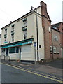
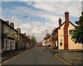
66 & 67 High Street, Madeley
A large, late 18th century town house, which developed over the following century or so as the premises of a prosperous grocer in Madeley, who added warehousing, outbuildings and cottages to the rear for his staff. The whole place was Grade II listed https://britishlistedbuildings.co.uk/101033279-66-and-67-high-street-madeley#.W88YZNQrLGg in 1983. Sadly some of the outbuildings have been demolished prior to the listing, but the essence of the group remains intact. It's currently in use as offices.
Image: © Richard Law
Taken: 8 Sep 2018
0.12 miles