IMAGES TAKEN NEAR TO
Court Street, TELFORD, TF7 5EG
Introduction
This page details the photographs taken nearby to Court Street, TF7 5EG by members of the Geograph project.
The Geograph project started in 2005 with the aim of publishing, organising and preserving representative images for every square kilometre of Great Britain, Ireland and the Isle of Man.

There are currently over 7.5m images from over14,400 individuals and you can help contribute to the project by visiting https://www.geograph.org.uk
Image Map
Images are licensed for reuse under creativecommons.org/licenses/by-sa/2.0
Notes
- Clicking on the map will re-center to the selected point.
- The higher the marker number, the further away the image location is from the centre of the postcode.
Image Listing (53 Images Found)
Images are licensed for reuse under creativecommons.org/licenses/by-sa/2.0
Image
Details
Distance
1

School Fields?
The fields that were formerly part of the school. I guess they still could be, but there are now railings that separate them.
Image: © Steve McShane
Taken: 12 Nov 2005
0.09 miles
2
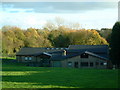
St Mary's RC School, Madeley
Madeley's Catholic Primary school for 5-11 year olds. This view was taken from what used to be the school's playing fields and football pitches. I'm not sure now though who owns the land.
Image: © Steve McShane
Taken: 12 Nov 2005
0.14 miles
3
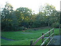
A place to play...
...for the local children of Coronation Crescent.
Image: © Steve McShane
Taken: 12 Nov 2005
0.14 miles
4
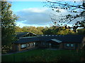
St Mary's 2
Closer shot of the school, where the entrances are.
Image: © Steve McShane
Taken: 12 Nov 2005
0.14 miles
5

Silkin Way cycle path, Madeley
A superb cycle path in Telford / Madeley.
Image: © TCExplorer
Taken: 22 Jul 2026
0.14 miles
6

Coalport Branch
Now a paved path and part of the National Cycle Network.
Image: © Richard Webb
Taken: 30 Jun 2014
0.17 miles
7

Madeley Court
Plenty of information about Madeley Court (now a hotel) here: http://www.madeleyparishcouncil.gov.uk/court.htm
Image: © Steve McShane
Taken: 12 Nov 2005
0.17 miles
8

Looking north along the Silkin Way
The Silkin Way is a 13-mile through-route connecting north to south Telford; in this southern section, it mostly follows the line of the former Coalport Branch of the London & Northwest Railway.
Image: © Richard Law
Taken: 26 Sep 2025
0.18 miles