
IMAGES TAKEN NEAR TO
The Rookery, TELFORD, TF7 5AW
Introduction
This page details the photographs taken nearby to The Rookery, TF7 5AW by members of the Geograph project.
The Geograph project started in 2005 with the aim of publishing, organising and preserving representative images for every square kilometre of Great Britain, Ireland and the Isle of Man.

There are currently over 7.5m images from over14,400 individuals and you can help contribute to the project by visiting https://www.geograph.org.uk
Image Map
Images are licensed for reuse under creativecommons.org/licenses/by-sa/2.0
Notes
- Clicking on the map will re-center to the selected point.
- The higher the marker number, the further away the image location is from the centre of the postcode.
Image Listing (98 Images Found)
Images are licensed for reuse under creativecommons.org/licenses/by-sa/2.0
Image
Details
Distance
1
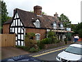
36 & 37 Station Road, Madeley
A row of 17th century, timber framed cottages, which were collectively Grade II listed https://britishlistedbuildings.co.uk/101352031-36-and-37-station-road-madeley#.W8WMEWhKhPY in 1983. There are several alterations and extensions (notably the dormer windows and additional rear wing) which date to the 19th century.
Image: © Richard Law
Taken: 8 Sep 2018
0.03 miles
2
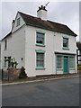
34 & 35 Station Road, Madeley
Described in its 1983 Grade II listing details https://britishlistedbuildings.co.uk/101033291-34-and-35-station-road-madeley#.W8WK4WhKhPY as 'stuccoed', there have apparently been alterations to remove that facing and return the walls to painted brickwork. The 19th century shopfront to the right is an addition to the 18th century house.
Image: © Richard Law
Taken: 8 Sep 2018
0.04 miles
3
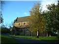
St Mary's Catholic Church, Madeley
Sadly, there aren't the number of priests nowadays as once there were, so St Mary's is part of the south Telford parish of The Good Shepherd. Here is a lovely little church for the good folk of Madeley and its surrounds.
Image: © Steve McShane
Taken: 12 Nov 2005
0.05 miles
4
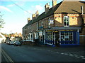
Charlie's Chippy
Almost anybody who has lived in South Telford will have had a bag of chips from Charlie's...
It stands on Madeley High St, now a one-way street.
Image: © Steve McShane
Taken: 12 Nov 2005
0.05 miles
5
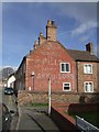
Advertising on the end terrace
A fading memory in Station Road.
Image: © John M
Taken: 9 Mar 2008
0.05 miles
6
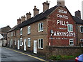
That's pushing it a bit...
A terrace of houses on Station Road in Madeley, with lettering making a somewhat inflated claim by the pill manufacturers! Surely, even in grim times, there was more to life than taking sugar-coated pills? Maybe not.
Image: © Richard Law
Taken: 8 Sep 2018
0.06 miles
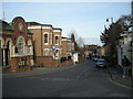
8
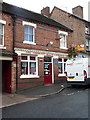
The CHEC offices
The acronym CHEC is the Community Health and Enterprise Centre, but it occupies a building that was formerly the Cooper's Arms pub which closed in 1907, also used later as a police station, boot maker's premises and hairdresser.
Image: © Richard Law
Taken: 8 Sep 2018
0.06 miles
9
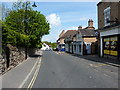
High Street, Madeley
A view down the main High Street of Madeley, nowadays a one-way thoroughfare for most of its length.
Image: © Richard Law
Taken: 15 May 2010
0.06 miles
10
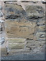
OS benchmark - Madeley, 70 High Street
The rather badly weathered remains of an OS cutmark in a stone wall on the north side of the High Street; originally levelled at 113.514m above Ordnance Datum Newlyn.
Image: © Richard Law
Taken: 19 Sep 2015
0.07 miles