
IMAGES TAKEN NEAR TO
Oak Close, TELFORD, TF7 4EG
Introduction
This page details the photographs taken nearby to Oak Close, TF7 4EG by members of the Geograph project.
The Geograph project started in 2005 with the aim of publishing, organising and preserving representative images for every square kilometre of Great Britain, Ireland and the Isle of Man.

There are currently over 7.5m images from over14,400 individuals and you can help contribute to the project by visiting https://www.geograph.org.uk
Image Map
Images are licensed for reuse under creativecommons.org/licenses/by-sa/2.0
Notes
- Clicking on the map will re-center to the selected point.
- The higher the marker number, the further away the image location is from the centre of the postcode.
Image Listing (19 Images Found)
Images are licensed for reuse under creativecommons.org/licenses/by-sa/2.0
Image
Details
Distance
1
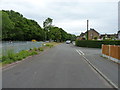
Kemberton Road, Madeley
Housing on the eastern side of Madeley, along Kemberton Road. The main route to Bridgnorth lies just a few metres to the left, beside the trees.
Image: © Richard Law
Taken: 4 Jun 2020
0.05 miles
2
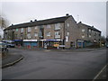
Parade of shops in Madeley
On the corner of Hills Lane Drive
Image: © Richard Law
Taken: 6 Feb 2010
0.10 miles
4
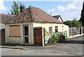
Old Toll House by Prince Street, Madeley
Toll House in the parish of Madeley, on Prince Street, South side of road.
Surveyed
Milestone Society National ID: SA.MAD02
Image: © Milestone Society
Taken: Unknown
0.12 miles
5
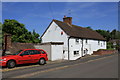
Old Toll House, Madeley
Toll House in the parish of Madeley at the junction of Hills Lane and Queen Street.
Surveyed
Milestone Society National ID: SA.MAD01
Image: © Milestone Society
Taken: Unknown
0.13 miles
6
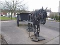
Pit pony outside the Miner's Arms
This statue near to the former Halesfield Colliery reminds me of Cervantes images.
Image: © John M
Taken: 9 Mar 2008
0.13 miles
7
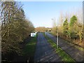
A4169
Serves the industrial estates at Halesfield.
Image: © Richard Webb
Taken: 16 Feb 2014
0.14 miles
9
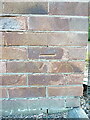
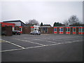
OS benchmark - Cuckoo Oak Fire Station building
An OS cutmark which dates from 1979, and lives on Image (basically by the yellow grit bin); it marks a point 101.264m above Ordnance Datum Newlyn.
Image: © Richard Law
Taken: 26 Jul 2024
0.15 miles
10
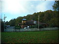
The Cuckoo Oak
Fairly spacious alehouse that will do large portions of food - if you're a Hungry Horse.. the pub is situated in front of the ambulance and fire stations.
Image: © Steve McShane
Taken: 12 Nov 2005
0.15 miles