
IMAGES TAKEN NEAR TO
Queen Street, TELFORD, TF7 4BH
Introduction
This page details the photographs taken nearby to Queen Street, TF7 4BH by members of the Geograph project.
The Geograph project started in 2005 with the aim of publishing, organising and preserving representative images for every square kilometre of Great Britain, Ireland and the Isle of Man.

There are currently over 7.5m images from over14,400 individuals and you can help contribute to the project by visiting https://www.geograph.org.uk
Image Map
Images are licensed for reuse under creativecommons.org/licenses/by-sa/2.0
Notes
- Clicking on the map will re-center to the selected point.
- The higher the marker number, the further away the image location is from the centre of the postcode.
Image Listing (47 Images Found)
Images are licensed for reuse under creativecommons.org/licenses/by-sa/2.0
Image
Details
Distance
1
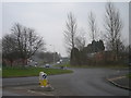
Madeley traffic roundabout looking towards the A442
Image: © Row17
Taken: 20 Feb 2008
0.03 miles
2
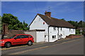
Old Toll House, Madeley
Toll House in the parish of Madeley at the junction of Hills Lane and Queen Street.
Surveyed
Milestone Society National ID: SA.MAD01
Image: © Milestone Society
Taken: Unknown
0.07 miles
3

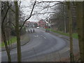
Parkway joins the Madeley Roundabout
A photo taken from the Silkin Way overbridge.
Image: © Richard Law
Taken: 26 Sep 2025
0.08 miles
5
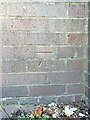
OS benchmark - Madeley, retaining wall at bottom of High St
An OS cutmark on a relatively modern piece of urban architecture - a retaining wall below the bridge which now carries the former railway line over the High St. It was cut and levelled in 1979, and marks a point 99.639m above Ordnance Datum Newlyn.
Image: © Richard Law
Taken: 26 Jul 2024
0.09 miles
6
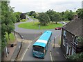
Forester's Arms
A pub seen from the Silkin Way at the east end of Madeley High Street.
Image: © Richard Webb
Taken: 30 Jun 2014
0.09 miles
7
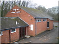
The Kingdom Hall of Jehovahs' Witnesses, Madeley
This hall was demolished in late 2011, and a new Kingdom Hall has now been erected.
Image: © Richard Law
Taken: 6 Feb 2010
0.09 miles
8
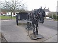
Pit pony outside the Miner's Arms
This statue near to the former Halesfield Colliery reminds me of Cervantes images.
Image: © John M
Taken: 9 Mar 2008
0.09 miles
9
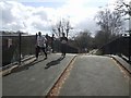
Runners on the Silkin Way
The Silkin Way, named after John Silkin, follow the line of the LNWR Coalport Branch. The runners in the Telford half marathon have climbed up from Blist's Hill Museum at some ten and a half miles and are looking the worse for wear.
Image: © John M
Taken: 9 Mar 2008
0.09 miles
10
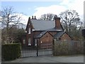
Madeley Market Station
On the LNWR Coalport Branch Line the station closed in 1953 after 90 years of use. Now restored and used by Social Services.
Image: © John M
Taken: 9 Mar 2008
0.11 miles