
IMAGES TAKEN NEAR TO
Cemetery Road, TELFORD, TF4 2BP
Introduction
This page details the photographs taken nearby to Cemetery Road, TF4 2BP by members of the Geograph project.
The Geograph project started in 2005 with the aim of publishing, organising and preserving representative images for every square kilometre of Great Britain, Ireland and the Isle of Man.

There are currently over 7.5m images from over14,400 individuals and you can help contribute to the project by visiting https://www.geograph.org.uk
Image Map
Images are licensed for reuse under creativecommons.org/licenses/by-sa/2.0
Notes
- Clicking on the map will re-center to the selected point.
- The higher the marker number, the further away the image location is from the centre of the postcode.
Image Listing (19 Images Found)
Images are licensed for reuse under creativecommons.org/licenses/by-sa/2.0
Image
Details
Distance
1

Houses on Park Road, Dawley Bank
These clearly pre-date the main period of development of Telford in the 1960s/70s,; the cottages at the far end look like late 19th century.
Image: © Richard Law
Taken: 23 Mar 2026
0.06 miles
2
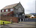
Beacon House, Dawley Bank
No longer the Wesleyan Sunday School that is marked on the plaque on the original remaining gable; this is now a private residence, and the gable is all that's left of the Methodist Chapel and Sunday School buildings.
Image: © Richard Law
Taken: 24 Jan 2010
0.07 miles
3
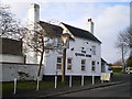
The Queen's Arms, Dawley Bank
A free house on Bank Road.
Image: © Richard Law
Taken: 24 Jan 2010
0.08 miles
4

Open land north of Park Road, Dawley Bank
Now pastureland, this area was previously mined for coal in the 18th and 19th centuries.
Image: © Richard Law
Taken: 23 Mar 2026
0.08 miles
5

Houses on Peveril Bank
Part of the Dawley Bank housing estate.
Image: © Richard Law
Taken: 23 Mar 2026
0.10 miles
6
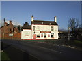
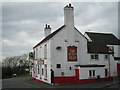
The Bulls Head, Dawley Bank, Telford and Wrekin
Much more of a 'traditional' boozer than the adjacent Wrekin View.
Image: © al partington
Taken: 5 Dec 2007
0.10 miles
8

Bungalows on Edward Parry Court in Dawley Bank
This part of the estate has the look of sheltered accommodation.
Image: © Richard Law
Taken: 23 Mar 2026
0.10 miles
9
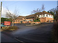
The Wrekin View, Dawley Bank, Telford and Wrekin
1980's Banks's brewery addition to Dawley Bank with a self-explanatory view.
Image: © al partington
Taken: 5 Dec 2007
0.11 miles
10

Houses on Peveril Bank
Poor pavement parking by the red van - that's really not very considerate at all.
Image: © Richard Law
Taken: 23 Mar 2026
0.11 miles