
IMAGES TAKEN NEAR TO
Old Coppice Grange, TELFORD, TF3 4TL
Introduction
This page details the photographs taken nearby to Old Coppice Grange, TF3 4TL by members of the Geograph project.
The Geograph project started in 2005 with the aim of publishing, organising and preserving representative images for every square kilometre of Great Britain, Ireland and the Isle of Man.

There are currently over 7.5m images from over14,400 individuals and you can help contribute to the project by visiting https://www.geograph.org.uk
Image Map
Images are licensed for reuse under creativecommons.org/licenses/by-sa/2.0
Notes
- Clicking on the map will re-center to the selected point.
- The higher the marker number, the further away the image location is from the centre of the postcode.
Image Listing (52 Images Found)
Images are licensed for reuse under creativecommons.org/licenses/by-sa/2.0
Image
Details
Distance
1
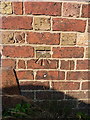
OS benchmark - Old Park, former chapel
An OS cutmark on the front of a former Methodist chapel on Park Lane (currently in use as a family engineering business or small workshop); the mark was originally levelled at 168.043m above Ordnance Datum Newlyn.
Image: © Richard Law
Taken: 9 Sep 2014
0.04 miles
2
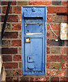
Redundant Victorian Post Box
This Victorian wall letter box has been inserted into the wall of an old chapel, in Old Park, Telford, that is used as a small factory.
The slot has had to be sealed, some folks thought it was still in use as a GPO box.
A lick of paint wouldn't go amiss!
Image: © Gordon Cragg
Taken: 1 Feb 2010
0.04 miles
3
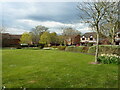
Green space and houses on The Crest
Part of the Old Park housing estate, just west of Telford centre.
Image: © Richard Law
Taken: 11 Apr 2022
0.05 miles
4
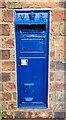
Smith & Hawkes Type Post Box
A Smith & Hawkes type Post Box with a Victoria Regina (VR) cipher. It was manufactured between 181-71. It is sited within the wall of a former Methodist Chapel
Image: © Anthony Rowley
Taken: 22 Jun 2021
0.05 miles
5
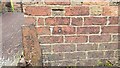
Benchmark
The OS Datum line and arrow sited on the Primitive Methodist Chapel in Old Park, Telford
Image: © Anthony Rowley
Taken: 1 Jan 1970
0.05 miles
6
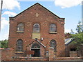
Old Park Primitive Methodist
Old Park Primitive Methodist (Bethesda) dated 1857, now used as commercial premises.
Image: © Sue Adair
Taken: 20 Jun 2011
0.05 miles
7
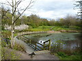
Northern margin of a pool in Old Park
An area of former coal pits and mining spoil, landscaped by the Telford Development Corporation in the 1960s or 1970s, and now a pleasant area of woodland, open grass and this pool. It appears to occupy the site of a former shaft, which has presumably been filled or capped.
Image: © Richard Law
Taken: 11 Apr 2022
0.05 miles
8
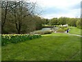
Pool in Old Park
The Old Park area is former mining country, marked on older maps with extensive shafts and spoil tips. This pool, as far as I can tell, occupies the site of coal shaft, and would probably have been landscaped in the 1960s or early 1970s.
Image: © Richard Law
Taken: 11 Apr 2022
0.07 miles
9
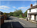
Park Lane in Old Park
Park Lane is one of the old routes through this part of Telford. and once connected Dawley Bank to Ketley through the Shropshire coalfield. It has been altered and interrupted in places now, and no longer runs the full distance.
Image: © Richard Law
Taken: 23 Sep 2023
0.08 miles
10
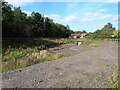
Balancing pond west of the new estate
A small attenuation pool to take rainwater run-off from the nearby new housing estate and slow its discharge into the local watercourses.
Image: © Richard Law
Taken: 23 Sep 2023
0.11 miles