
IMAGES TAKEN NEAR TO
Park Lane, TELFORD, TF3 4TG
Introduction
This page details the photographs taken nearby to Park Lane, TF3 4TG by members of the Geograph project.
The Geograph project started in 2005 with the aim of publishing, organising and preserving representative images for every square kilometre of Great Britain, Ireland and the Isle of Man.

There are currently over 7.5m images from over14,400 individuals and you can help contribute to the project by visiting https://www.geograph.org.uk
Image Map
Images are licensed for reuse under creativecommons.org/licenses/by-sa/2.0
Notes
- Clicking on the map will re-center to the selected point.
- The higher the marker number, the further away the image location is from the centre of the postcode.
Image Listing (61 Images Found)
Images are licensed for reuse under creativecommons.org/licenses/by-sa/2.0
Image
Details
Distance
1
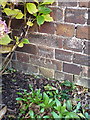
OS benchmark - Old Park Methodist Church
An OS cutmark on the front porch of the former Methodist Church, Old Park. Now apparently converted to a private residence. The mark was originally levelled at 180.239m above Ordnance Datum Newlyn.
Image: © Richard Law
Taken: 1 Dec 2013
0.01 miles
2
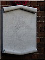
WWI memorial - Old Park Methodist Church
A rather poignant reminder of the sacrifices made in the first war; this plaque lists the names of 13 men from the small village of Old Park who died in the Great War, of whom there appear to be 3 sets of brothers.
Image: © Richard Law
Taken: 1 Dec 2013
0.01 miles
3
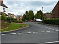
Houses on The Coppice, Old Park
This short residential road occupies the route of a one-time mining track which lead from Park Lane into the heavily mined area of Old Park.
Image: © Richard Law
Taken: 11 Apr 2022
0.02 miles
4
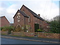
Old Park Methodist Chapel
A former Methodist Chapel in the village of Old Park, now converted to a private dwelling. It was erected in 1853.
Image: © Richard Law
Taken: 1 Dec 2013
0.03 miles
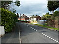
6
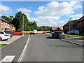
Cul-de-sac road on Cinderloo Way
Most of the roads around this brand new housing estate are named Cinderloo Way, presumably in recognition of the Cinderloo Uprising (Wikipedia https://en.wikipedia.org/wiki/Cinderloo_Uprising ) which took place in this area in April 1821. A large number of miners, disgruntled at a pay cut, took on the Shropshire Yeomanry, who had been called in to keep the peace. The disturbances led to 3 deaths, including the subsequent hanging of one of the ringleaders of the strikers.
Image: © Richard Law
Taken: 23 Sep 2023
0.07 miles
7
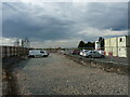
Site offices for a housing development
The mortar silo gives the game away; there are more new houses to be built, here infilling a small corner of Old Park
Image: © Richard Law
Taken: 11 Apr 2022
0.08 miles
8
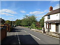
Park Lane in Old Park
Park Lane is one of the old routes through this part of Telford. and once connected Dawley Bank to Ketley through the Shropshire coalfield. It has been altered and interrupted in places now, and no longer runs the full distance.
Image: © Richard Law
Taken: 23 Sep 2023
0.08 miles
9

Car park and shops on Forge Retail Park
Image: © Richard Law
Taken: 11 Apr 2022
0.09 miles
10
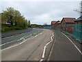
New-build houses on Colliers Way, The Rock
Image: © Richard Law
Taken: 16 Apr 2023
0.10 miles