IMAGES TAKEN NEAR TO
Telford 54 Business Park, Nedge Hill, TELFORD, TF3 3AL
Introduction
This page details the photographs taken nearby to Telford 54 Business Park, Nedge Hill, TF3 3AL by members of the Geograph project.
The Geograph project started in 2005 with the aim of publishing, organising and preserving representative images for every square kilometre of Great Britain, Ireland and the Isle of Man.

There are currently over 7.5m images from over14,400 individuals and you can help contribute to the project by visiting https://www.geograph.org.uk
Image Map
Images are licensed for reuse under creativecommons.org/licenses/by-sa/2.0
Notes
- Clicking on the map will re-center to the selected point.
- The higher the marker number, the further away the image location is from the centre of the postcode.
Image Listing (16 Images Found)
Images are licensed for reuse under creativecommons.org/licenses/by-sa/2.0
Image
Details
Distance
2
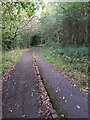
Shared-use path south of Randlay Interchange
Built for cycles on one lane and pedestrians on the other, with the two separated by that line of old stone setts. They have proved to be a blessed menace to cyclists switching 'tracks' elsewhere in Telford, resulting in a number of accidents, and many stretches of the setts have now been removed in favour of white lines over the years.
Image: © Richard Law
Taken: 13 Sep 2024
0.08 miles

4
Shared-use path south of Randlay Interchange
A useful link for cyclists and pedestrians between the Randlay housing estate and the offices & businesses on Stafford Park industrial estate. I suspect it gets a bit of illicit motorbike traffic too.
Image: © Richard Law
Taken: 13 Sep 2024
0.12 miles
5

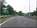
A442 Queensway looking south
A view southwards, down the 'Eastern Primary' road (its original and rather unimaginative name before it was given Queensway) in the general direction of Stirchley.
Image: © Richard Law
Taken: 13 Sep 2024
0.13 miles
6

Traffic on the southern side of Randlay Interchange
There was actually quite a lot more traffic than this photo implies - I waited for the lights to change and the queue to clear before clicking the virtual shutter button.
Image: © Richard Law
Taken: 13 Sep 2024
0.14 miles
7
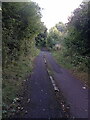
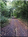
Shared-use path south of Randlay Interchange
Although it looks quite isolated and rural here, the reality is a busy dual carriageway just a few yards to the right (west) and a now-disused railway to the east.
Image: © Richard Law
Taken: 13 Sep 2024
0.17 miles
8
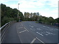
Part-time lights on Randlay Interchange roundabout
Image: © Richard Law
Taken: 13 Sep 2024
0.19 miles
9
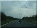
Queensway
The main road through Telford, also known by its former name, the Eastern Primary route. In the distance is a new bridge built a few years ago to mark the exact centre of Telford (so I am led to believe, but don't actually believe).
Took a bit of traffic-dodging for me to get this shot...
Image: © Steve McShane
Taken: 15 Apr 2006
0.19 miles