
IMAGES TAKEN NEAR TO
Dunsheath, TELFORD, TF3 2BY
Introduction
This page details the photographs taken nearby to Dunsheath, TF3 2BY by members of the Geograph project.
The Geograph project started in 2005 with the aim of publishing, organising and preserving representative images for every square kilometre of Great Britain, Ireland and the Isle of Man.

There are currently over 7.5m images from over14,400 individuals and you can help contribute to the project by visiting https://www.geograph.org.uk
Image Map
Images are licensed for reuse under creativecommons.org/licenses/by-sa/2.0
Notes
- Clicking on the map will re-center to the selected point.
- The higher the marker number, the further away the image location is from the centre of the postcode.
Image Listing (48 Images Found)
Images are licensed for reuse under creativecommons.org/licenses/by-sa/2.0
Image
Details
Distance
1
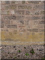
OS benchmark - Hollinswood, rear of 19 Dunsheath
OS cutmark in the garden wall at the rear of no 19 Dunsheath; originally levelled in 1984 at 139.933m above Ordnance Datum Newlyn.
Image: © Richard Law
Taken: 21 Apr 2014
0.08 miles
2
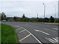
Hollinsgate road approaches the Hollinswood roundabout
Image: © Richard Law
Taken: 16 Apr 2023
0.10 miles
3
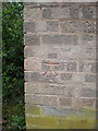
OS benchmark - Hollinswood, no 65 Duffryn
An OS cutmark on a garden wall belonging to no 65 Duffryn; originally levelled in 1984 at 136.598m above Ordnance Datum Newlyn.
Image: © Richard Law
Taken: 6 Apr 2014
0.12 miles
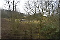
5
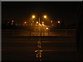
Telford: Hollinswood Roundabout
A line of street lights disappears into the distance down the central reservation of the A442 towards Whitchurch.
Image: © Chris Downer
Taken: 16 Dec 2007
0.12 miles
6

Footway beneath Hollinswood roundabout
A useful pedestrian route from Stafford Park industrial/business park, to the Telford Central railway station. It runs right alongside the tracks here.
Image: © Richard Law
Taken: 3 Jun 2022
0.13 miles
7
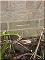
OS benchmark - Hollinswood, rear of 133 Dunsheath
An OS benchmark in the bricks of the garden wall at the rear of 133 Dunsheath, facing onto Dale Acre Way. Originally levelled in 1984 at 150.697m above Ordnance Datum Newlyn.
Image: © Richard Law
Taken: 21 Apr 2014
0.14 miles
8
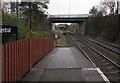
From Telford Central railway station towards two road bridges
From the southeast end of the station towards bridges in the Hollinswood Interchange at the A5/A442 junction.
The bridges are 125 metres apart.
Image: © Jaggery
Taken: 26 Nov 2015
0.14 miles
9

Footway below Hollinswood roundabout
A useful pedestrian route between Stafford Park industrial/business park and the Telford Central railway station. It runs right alongside the tracks here.
Image: © Richard Law
Taken: 3 Jun 2022
0.16 miles
10
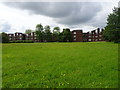
Malins Lee railway station (site), Shropshire
Opened in 1860 by the London & North Western Railway on its line from Wellington to Coalport East, this station closed to passengers in 1952 and completely in 1964.
View south towards Stirchley and Coalport along the site of the single track. Platform and station building were to the right of the track. It's hard to believe now but old photographs show spoil heaps from the area's coal mining would have been to the right of the image, behind the station. Today, the area has been completely redeveloped and is near Telford town centre.
Image: © Nigel Thompson
Taken: 9 Jun 2019
0.16 miles