
IMAGES TAKEN NEAR TO
Birchmore, TELFORD, TF3 1TL
Introduction
This page details the photographs taken nearby to Birchmore, TF3 1TL by members of the Geograph project.
The Geograph project started in 2005 with the aim of publishing, organising and preserving representative images for every square kilometre of Great Britain, Ireland and the Isle of Man.

There are currently over 7.5m images from over14,400 individuals and you can help contribute to the project by visiting https://www.geograph.org.uk
Image Map
Images are licensed for reuse under creativecommons.org/licenses/by-sa/2.0
Notes
- Clicking on the map will re-center to the selected point.
- The higher the marker number, the further away the image location is from the centre of the postcode.
Image Listing (9 Images Found)
Images are licensed for reuse under creativecommons.org/licenses/by-sa/2.0
Image
Details
Distance
1
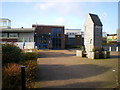
Main entrance - The Windmill primary school
At first, I couldn't work out why they call the place 'The Windmill'. Then, right outside the main entrance, all becomes clear.
Image: © Richard Law
Taken: 5 Dec 2009
0.19 miles
2
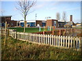
The Windmill Primary school & children's centre
Image: © Richard Law
Taken: 5 Dec 2009
0.20 miles
3

Looking north along the Silkin Way
The Silkin Way is a 13-mile through-route connecting north to south Telford; at this stage, it follows the route of the former Coalport Branch of the London & Northwest Railway.
Image: © Richard Law
Taken: 26 Sep 2025
0.22 miles
4
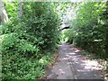
Wellington and Coalport Branch
A path through wooded former industrial land.
Image: © Richard Webb
Taken: 30 Jun 2014
0.23 miles
5
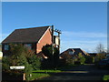
Silkin View
Well, it's not far from a view of the Silkin Way...
Modern housing with a slightly older contraption for holding telephone wires...
Image: © Steve McShane
Taken: 12 Nov 2005
0.23 miles
6
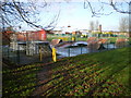
Bike park and play area, Brookside
A small play area for BMX bikes and the like, in the middle of the Brookside estate. The Windmill primary school is in the background.
Image: © Richard Law
Taken: 5 Dec 2009
0.24 miles
7

The Silkin Way cycle path near Stirchley
Image: © TCExplorer
Taken: 22 Jul 2026
0.24 miles
8
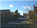
The Rowans
This housing estate was built in 1983/4. The view is up the hill looking towards Sambrook Close, Chetwynd Close and Stockton Close.
Image: © Steve McShane
Taken: 12 Nov 2005
0.25 miles
9

Silkin Way bridge under Southall Road
Interestingly, this bridge is a later addition to the former railway line, as it wasn't here in the 1800s. Appears to have been built sometime after 1921. It is not marked on historical Ordnance Survey maps (i.e. OS Six Inch, 1888-1915).
Image: © TCExplorer
Taken: 22 Jul 2026
0.25 miles