
IMAGES TAKEN NEAR TO
Burnside, TELFORD, TF3 1SU
Introduction
This page details the photographs taken nearby to Burnside, TF3 1SU by members of the Geograph project.
The Geograph project started in 2005 with the aim of publishing, organising and preserving representative images for every square kilometre of Great Britain, Ireland and the Isle of Man.

There are currently over 7.5m images from over14,400 individuals and you can help contribute to the project by visiting https://www.geograph.org.uk
Image Map
Images are licensed for reuse under creativecommons.org/licenses/by-sa/2.0
Notes
- Clicking on the map will re-center to the selected point.
- The higher the marker number, the further away the image location is from the centre of the postcode.
Image Listing (15 Images Found)
Images are licensed for reuse under creativecommons.org/licenses/by-sa/2.0
Image
Details
Distance
1
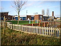
The Windmill Primary school & children's centre
Image: © Richard Law
Taken: 5 Dec 2009
0.14 miles
2
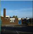
Brindleyford Primary School
The playground and the entrance to the school (reception towards the right of the picture), taken from between the barriers that allow access to the school. The school opened in 1974, is non-demoninational and is for 5-9 year olds.
Image: © Steve McShane
Taken: 12 Nov 2005
0.14 miles
3
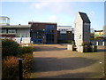
Main entrance - The Windmill primary school
At first, I couldn't work out why they call the place 'The Windmill'. Then, right outside the main entrance, all becomes clear.
Image: © Richard Law
Taken: 5 Dec 2009
0.14 miles
4
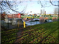
Bike park and play area, Brookside
A small play area for BMX bikes and the like, in the middle of the Brookside estate. The Windmill primary school is in the background.
Image: © Richard Law
Taken: 5 Dec 2009
0.18 miles
5
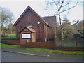
Scout Group hall, Aqueduct
The headquarters of Brookside Scout group, in a converted chapel dating from 1851.
Image: © Richard Law
Taken: 5 Dec 2009
0.18 miles
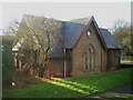
7
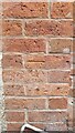
St Paul's Benchmark, Aqueduct
The OS Cut Benchmark on the former St Paul's Church in Aqueduct, Telford, Shropshire. The Church is refurbished to become a residential building.
Image: © Anthony Rowley
Taken: 22 Jul 2021
0.21 miles
8
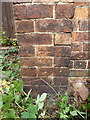
OS benchmark - Aqueduct, Methodist Hall
An OS cutmark on the south-facing wall of a small methodist chapel/hall on Aqueduct Road; originally levelled at 127.538m above Ordnance Datum Newlyn.
Image: © Richard Law
Taken: 15 Aug 2015
0.21 miles
9
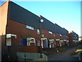
Burtondale Flats
Picturesque 60s/70s council housing in Brookside. The path continues on up toward Brookside Shops.
Image: © Steve McShane
Taken: 12 Nov 2005
0.22 miles
10

OS rivet - Brookside, subway wall
An OS rivet on the concrete revetment wall of the subway on Brookside Avenue; originally levelled at 121.448m above Ordnance Datum Newlyn.
Image: © Richard Law
Taken: 15 Aug 2015
0.23 miles