1
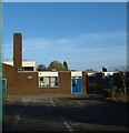
Burtondale Flats
Picturesque 60s/70s council housing in Brookside. The path continues on up toward Brookside Shops.
Image: © Steve McShane
Taken: 12 Nov 2005
0.02 miles
2
Blakemore housing
More council housing...
Image: © Steve McShane
Taken: 12 Nov 2005
0.06 miles
3
35-38 Brereton
Local council housing, built in the early 1970s.
Image: © Steve McShane
Taken: 12 Nov 2005
0.08 miles
4
Brereton Housing and play area
There used to be a slide here as part of the amusement, but that has probably long since gone. The housing remains though, with one local resident making some improvements at the time of the photograph! Sadly, someone has applied their own message to the L-shaped wall - a sign of the times?
Image: © Steve McShane
Taken: 12 Nov 2005
0.08 miles
5
Recreation in Brereton
Another view of the recreation area among the houses... Someone's helpfully painted a goal for the local kids.
Image: © Steve McShane
Taken: 12 Nov 2005
0.08 miles
6
Bike park and play area, Brookside
A small play area for BMX bikes and the like, in the middle of the Brookside estate. The Windmill primary school is in the background.
Image: © Richard Law
Taken: 5 Dec 2009
0.14 miles
7
The Windmill Primary school & children's centre
Image: © Richard Law
Taken: 5 Dec 2009
0.14 miles
8
Main entrance - The Windmill primary school
At first, I couldn't work out why they call the place 'The Windmill'. Then, right outside the main entrance, all becomes clear.
Image: © Richard Law
Taken: 5 Dec 2009
0.16 miles
9
OS benchmark - Brookside, 1 Brereton
An OS cutmark on the end face of a garden wall; originally levelled at 127.06m above Ordnance Datum Newlyn.
Image: © Richard Law
Taken: 15 Aug 2015
0.16 miles
10
Brindleyford Primary School
The playground and the entrance to the school (reception towards the right of the picture), taken from between the barriers that allow access to the school. The school opened in 1974, is non-demoninational and is for 5-9 year olds.
Image: © Steve McShane
Taken: 12 Nov 2005
0.16 miles


