
IMAGES TAKEN NEAR TO
Ragged Robins Close, TELFORD, TF2 9UF
Introduction
This page details the photographs taken nearby to Ragged Robins Close, TF2 9UF by members of the Geograph project.
The Geograph project started in 2005 with the aim of publishing, organising and preserving representative images for every square kilometre of Great Britain, Ireland and the Isle of Man.

There are currently over 7.5m images from over14,400 individuals and you can help contribute to the project by visiting https://www.geograph.org.uk
Image Map
Images are licensed for reuse under creativecommons.org/licenses/by-sa/2.0
Notes
- Clicking on the map will re-center to the selected point.
- The higher the marker number, the further away the image location is from the centre of the postcode.
Image Listing (15 Images Found)
Images are licensed for reuse under creativecommons.org/licenses/by-sa/2.0
Image
Details
Distance
1
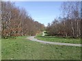
Footpath through 'The Rookery'
Early Spring day in the silver birch woodland.
Image: © John M
Taken: 21 Mar 2007
0.09 miles
2
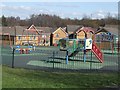
New housing estate with play area
Attention has been given to safe surfaces around the equipment on the play area. The children need this area as the houses are very close together.
Image: © John M
Taken: 21 Mar 2007
0.10 miles
3
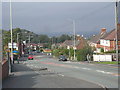
Looking north along Gower St, St George's, Telford
Image: © Row17
Taken: 6 Oct 2008
0.16 miles
4
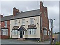
The Talbot, St Georges
The most northerly of the remaining pubs of St Georges.
Image: © Mike White
Taken: 17 Jul 2008
0.16 miles
5
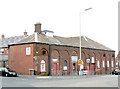
'The Trading Post', St. Georges
The Trading Post in Gower St, St. Georges, a most useful place for the DIY enthusiast; the building is one of the few remaining remnants of the great "New Works" foundry of the once mighty Lilleshall Company.
Image: © Gordon Cragg
Taken: 19 Feb 2009
0.16 miles
6
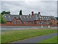
The Gower St School
According to "Here be Dragons", by Gillian M James, this building was erected in 1873 as a hospital, by the Lilleshall Company. It was too large and was taken over by Wrockwardine Wood Parish to be used as a school. More recently it became Oakengates Youth Club, subsequently the Youth Centre. Now it is closed and being vandalised. It is likely to be demolished to make room for housing.
Image: © Mike White
Taken: 17 Jul 2008
0.16 miles
7
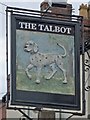
The Talbot pub sign
The hound has seen better days but still looks bold and determined. An unusual bas-relief sign.
Image: © Mike White
Taken: 17 Jul 2008
0.17 miles
8
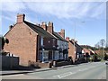
Gower Road, St Georges
Talbot Villa and the Talbot Inn date from the 1890s.
Image: © John M
Taken: 21 Mar 2007
0.17 miles
9
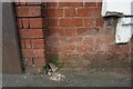
New Yard, St Georges
The OS benchmark cut into the former New Yard Engineering Works in St. Georges, Telford. It was levelled in 1961 and last verified by the OS in 1985. It is recorded as being 141.37-metres above the Ordnance Datum at Newlyn
Image: © Anthony Rowley
Taken: 16 Nov 2021
0.17 miles
10
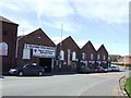
Gower Street Trading Estate
Old factory units in St George's have now found new users, tyre fitters and double glazing.
Image: © John M
Taken: 21 Mar 2007
0.17 miles