
IMAGES TAKEN NEAR TO
William Doody Close, TELFORD, TF2 9TN
Introduction
This page details the photographs taken nearby to William Doody Close, TF2 9TN by members of the Geograph project.
The Geograph project started in 2005 with the aim of publishing, organising and preserving representative images for every square kilometre of Great Britain, Ireland and the Isle of Man.

There are currently over 7.5m images from over14,400 individuals and you can help contribute to the project by visiting https://www.geograph.org.uk
Image Map
Images are licensed for reuse under creativecommons.org/licenses/by-sa/2.0
Notes
- Clicking on the map will re-center to the selected point.
- The higher the marker number, the further away the image location is from the centre of the postcode.
Image Listing (29 Images Found)
Images are licensed for reuse under creativecommons.org/licenses/by-sa/2.0
Image
Details
Distance
1
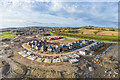
New homes being constructed in Priorslee
A new housing development being built.
Image: © Andrew Abbott
Taken: 16 Mar 2020
0.04 miles
2
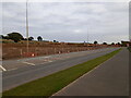
New housing development near Priorslee
The next phase of the ever-growing Priorslee housing estate has broken ground in recent weeks in the area between Castle Farm Way (foreground) and Woodhouse Lane. This will build on the field, and several others, which were photographed a year ago in Image
Image: © Richard Law
Taken: 16 Oct 2021
0.08 miles
3
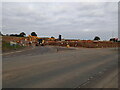
Entrance to a new housing site
The next phase of the ever-growing Priorslee housing estate has broken ground in recent weeks in the area between Castle Farm Way (foreground) and Woodhouse Lane. This is the entrance to the site, which will build on the field, and several others, which were photographed a year ago in Image
Image: © Richard Law
Taken: 16 Oct 2021
0.09 miles

5
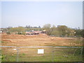
Telford never seems to stop growing
More new housing being built on the SE side of the existing Priorslee estates; this development by Redrow Homes is known as Abbey Fields, and will shortly be the proud site of lots more 2, 3 & 4 bedroom houses.
Image: © Richard Law
Taken: 7 Apr 2019
0.16 miles
6

View across Priorslee Lake
Castle Farm Reservoir is the formal name for this lake, which was created in the 1980s to take rainwater drainage from the (proposed, at that time) housing estates to the north, and release it slowly into the Wesley Brook.
Image: © Richard Law
Taken: 30 Jul 2025
0.16 miles
7

Sailing on Priorslee Lake, Autumn 1987
Precise date not recorded, unfortunately, but this image of a dinghy and a couple of windsurfers was taken in August or September 1987 on the relatively newly-flooded Castle Farm Reservoir, which is now known as Priorslee Lake. Its main purpose is to take drainage from the housing estates of Priorslee to the north, and to a lesser extent the motorway to the south, and release it gradually into the Wesley Brook which runs through Shifnal and on to the River Worfe. It's always been home to a small sailing club, and is also a local nature reserve.
Image: © Richard Law
Taken: Unknown
0.16 miles
8
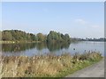
Priorslee Lake
Home to a large flock of gulls.
Image: © John M
Taken: 23 Oct 2007
0.18 miles
9

Giant Hogweed by Wesley Brook
This unpleasant giant is blooming where the Wesley Brook enters Castle Farm Lake. More details of the plant are in Image
Image: © Mike White
Taken: 31 May 2020
0.18 miles
10
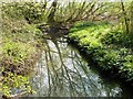
Wesley Brook flows into Priorslee Lake
Well, there's the brook; and there's the lake. The obstruction doesn't stop the water. I didn't want to disturb a nesting swan (not visible here), so was less intrepid than usual.
Image: © Mike White
Taken: 12 Apr 2009
0.18 miles