IMAGES TAKEN NEAR TO
Bayswater Close, TELFORD, TF2 9GY
Introduction
This page details the photographs taken nearby to Bayswater Close, TF2 9GY by members of the Geograph project.
The Geograph project started in 2005 with the aim of publishing, organising and preserving representative images for every square kilometre of Great Britain, Ireland and the Isle of Man.

There are currently over 7.5m images from over14,400 individuals and you can help contribute to the project by visiting https://www.geograph.org.uk
Image Map
Images are licensed for reuse under creativecommons.org/licenses/by-sa/2.0
Notes
- Clicking on the map will re-center to the selected point.
- The higher the marker number, the further away the image location is from the centre of the postcode.
Image Listing (14 Images Found)
Images are licensed for reuse under creativecommons.org/licenses/by-sa/2.0
Image
Details
Distance
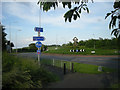
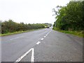
1
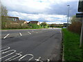
Castle Farm Way, A4640, looking south
One of the main routes between south and north Telford
Image: © Richard Law
Taken: 1 Apr 2024
0.05 miles
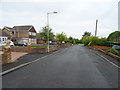
2
Pedestrian Crossing Castle Farm Way Telford
Image: © Roy Hughes
Taken: 24 Feb 2014
0.05 miles
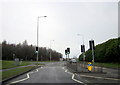
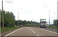
4
Approaching Limekiln Bank Roundabout on A5
Image: © John Firth
Taken: 9 Mar 2015
0.10 miles
5
A traffic island on the A5
The sculpture on the island is a representation of Thomas Telford's mason's mark.
Image: © Row17
Taken: 4 Jun 2008
0.11 miles
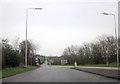
6
Roundabout north of Priorslea
From A4640
Image: © John Firth
Taken: 19 Jun 2012
0.11 miles
7
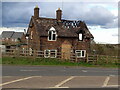
Redhill Cottage
Not long for this world by the look of things - the fire damage is a relatively recent development; since Autumn 2023 at any rate. Google Streetview suggests it was last occupied and well-kept in July 2011, and since then has been getting progressively more untidy, with the house building work to the east becoming much more noticeable in the last year or two.
Image: © Richard Law
Taken: 1 Apr 2024
0.12 miles
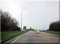
8
A5 Heading Eastwards From Limekiln Bank Roundabout
Image: © Roy Hughes
Taken: 24 Feb 2014
0.12 miles
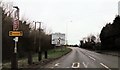
9
Priorslee, Watling Street
A5, Holyhead Road, part of Roman Watling Street, from Hadrian's Wall to Dover.
Image: © Mike Faherty
Taken: 14 Oct 2014
0.15 miles
10
Limekiln Bank, St George's
Looking east on National Cycle Route 81.
Image: © JThomas
Taken: 18 May 2019
0.18 miles