
IMAGES TAKEN NEAR TO
Cloisters Way, TELFORD, TF2 9FY
Introduction
This page details the photographs taken nearby to Cloisters Way, TF2 9FY by members of the Geograph project.
The Geograph project started in 2005 with the aim of publishing, organising and preserving representative images for every square kilometre of Great Britain, Ireland and the Isle of Man.

There are currently over 7.5m images from over14,400 individuals and you can help contribute to the project by visiting https://www.geograph.org.uk
Image Map
Images are licensed for reuse under creativecommons.org/licenses/by-sa/2.0
Notes
- Clicking on the map will re-center to the selected point.
- The higher the marker number, the further away the image location is from the centre of the postcode.
Image Listing (16 Images Found)
Images are licensed for reuse under creativecommons.org/licenses/by-sa/2.0
Image
Details
Distance
1
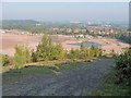
Clay pit being landscaped
This is Image, photographed from the same position, three months later. The diminished lake seems likely to remain but I think the fish the Lilco (Lilleshall Company) anglers club used to pursue will have gone.
Image: © Mike White
Taken: 27 Sep 2008
0.04 miles
2

Landscaped Clay Pit, St Georges
The process seen in Image and Image is nearly complete. The pond has been restored and fenced off. The site is now ready for building.
This panorama, assembled from two shots in Photoshop Elements 7, shows the Wrekin and Ercall hills to the left and the North Shropshire Plain centre and right. The A4640 Red Hill Way runs down the right-hand side.
Image: © Mike White
Taken: 25 May 2009
0.07 miles
3
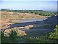
Clay Pit
This old clay pit was almost disused until the last year or so, when activity resumed and a lot of spoil has been moved, presumably with a view to housebuilding. The area north of the pit has been built on in the last decade or so. The pool was used by anglers.
Image: © Mike White
Taken: 1 Jul 2008
0.08 miles
4

The Rights of Way people have been busy
Smart new steps and a small bridge over a minor brook on the path north of St Georges
Image: © Richard Law
Taken: 6 Feb 2011
0.10 miles
5

Bridge over the B5060
Footbridge only (OK, mountain bikes on this occasion too) leading the footpath from St Georges through towards the Granville Country Park area to the east of the main B5060
Image: © Richard Law
Taken: 6 Feb 2011
0.11 miles
6
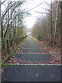
Steps on footway beside the B5060
These steps run down from the Image onto a track which leads into the industrial park at Donnington Wood. Easy to ride down on a bike; they require a certain rhythm to ride up successfully.
Image: © Richard Law
Taken: 14 Jan 2017
0.11 miles
7

Telford & Wrekin Hockey Club pitches
According to my 1:25,000 map, the footpath goes diagonally across these two artificial pitches. I guess it must have been diverted since the surrounding fence was erected, as it now follows the western edge just out of shot.
Image: © Richard Law
Taken: 6 Feb 2011
0.17 miles
8

Housing estate north of St George's
As John says in Image, the roads have a 'cricketing' theme; in this case we're looking along Lords Drive, with Checkley Lane on the right. Others on the same estate include Oval Close and Cricketers Lane.
Image: © Richard Law
Taken: 6 Feb 2011
0.19 miles
10
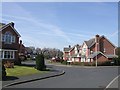
Bowled over
An estate of modern houses; the street names have a test cricket grounds theme.
Image: © John M
Taken: 4 Apr 2007
0.20 miles