
IMAGES TAKEN NEAR TO
Manor Drive, TELFORD, TF2 9DJ
Introduction
This page details the photographs taken nearby to Manor Drive, TF2 9DJ by members of the Geograph project.
The Geograph project started in 2005 with the aim of publishing, organising and preserving representative images for every square kilometre of Great Britain, Ireland and the Isle of Man.

There are currently over 7.5m images from over14,400 individuals and you can help contribute to the project by visiting https://www.geograph.org.uk
Image Map
Images are licensed for reuse under creativecommons.org/licenses/by-sa/2.0
Notes
- Clicking on the map will re-center to the selected point.
- The higher the marker number, the further away the image location is from the centre of the postcode.
Image Listing (28 Images Found)
Images are licensed for reuse under creativecommons.org/licenses/by-sa/2.0
Image
Details
Distance
1
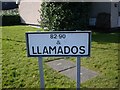
I couldn't resist it.
Perhaps the spelling should be Llamedos?
Image: © Mike White
Taken: 20 Feb 2009
0.03 miles
2
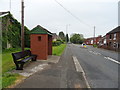
Stafford Street, St George's, Telford
Looking north east.
Image: © JThomas
Taken: 18 May 2019
0.06 miles
3
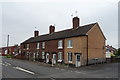
Houses on Stafford Street, St George's, Telford
Image: © JThomas
Taken: 18 May 2019
0.06 miles
4
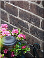
OS benchmark - Snedshill, no 1 Furnace Lane
An OS cutmark in the brickwork at the side of no 1 Furnace Lane; originally levelled in 1985 at 173.277m above Ordnance Datum Newlyn.
Image: © Richard Law
Taken: 10 May 2014
0.08 miles
5
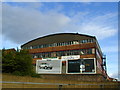
View of part of the Snedshill Trading Estate.
Taken from the Greyhound Roundabout on the old A5, where it bridges the main Eastern Primary route of Telford.
Image: © Bob Bowyer
Taken: 7 Sep 2005
0.13 miles
6
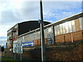
Former metal works at Oakengates
These buildings were revitalised with the development of the New Town of Telford in the 1970s, as workshops and small businesses.
Image: © Bob Bowyer
Taken: 3 Sep 2005
0.13 miles
7

OS benchmark - St George's, 102 Freeston Avenue
An OS cutmark in the brickwork at the side of 102 Freeston Avenue; originally levelled in 1985 at 170.31m above Ordnance Datum Newlyn.
Image: © Richard Law
Taken: 10 May 2014
0.18 miles
8
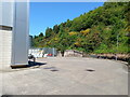
A peek round the back of the Aldi store
HGV access to the rear of the supermarket and the adjoining home improvements store (Aldi and Wickes respectively) which now occupy the land on Snedshill that was once home to the Lilleshall Company.
Image: © Richard Law
Taken: 3 Jun 2023
0.19 miles
9
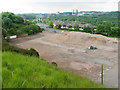
Snedshill Factory Site
This site was cleared in 2008 for erection of a hardware store. The location of the old Snedshill Brick Works lies under the pile of broken brick. The building in geographs Image, Image and Image Image has gone. In the background: Central Park, and behind it, Telford Town Centre. On the skyline, an isolated chimney: Stirchley Stack.
Image: © Mike White
Taken: 30 May 2008
0.20 miles
10
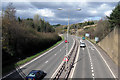
Queensway, Telford
The A442 Queensway (aka The Eastern Primary) looking North from the Greyhound Interchange.
Image: © Gordon Cragg
Taken: 26 Mar 2009
0.20 miles