
IMAGES TAKEN NEAR TO
The Nabb, TELFORD, TF2 9BY
Introduction
This page details the photographs taken nearby to The Nabb, TF2 9BY by members of the Geograph project.
The Geograph project started in 2005 with the aim of publishing, organising and preserving representative images for every square kilometre of Great Britain, Ireland and the Isle of Man.

There are currently over 7.5m images from over14,400 individuals and you can help contribute to the project by visiting https://www.geograph.org.uk
Image Map
Images are licensed for reuse under creativecommons.org/licenses/by-sa/2.0
Notes
- Clicking on the map will re-center to the selected point.
- The higher the marker number, the further away the image location is from the centre of the postcode.
Image Listing (29 Images Found)
Images are licensed for reuse under creativecommons.org/licenses/by-sa/2.0
Image
Details
Distance
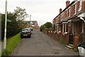
2
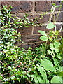
OS benchmark - Oakengates, 68 The Nabb
An OS cutmark on the brickwork of no68 The Nabb (Diamond Row); originally levelled in 1961 at 145.62m above Ordnance Datum Newlyn.
Image: © Richard Law
Taken: 10 May 2014
0.06 miles
3
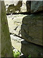
OS benchmark - Oakengates, Station Hill
An OS cutmark in a stone wall on the N side of the steep Station Hill; originally levelled in 1960 at 147.25m above Ordnance Datum Newlyn.
Image: © Richard Law
Taken: 10 May 2014
0.06 miles
4
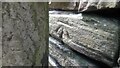
Cut Benchmark
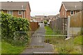
An Ordnance Survey cut benchmark into an old wall on Station Hill between Oakengates and St Georges. The benchmark is slightly eroded and hidden behind a lamp post
Image: © Anthony Rowley
Taken: 20 Apr 2021
0.07 miles
6
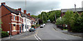
Station Hill, Oakengates
Station Hill, Oakengates looking up towards St Georges. The large building on the right was an old chapel that was converted into a residential home for homeless youngsters by the Anneka Rice make-over programme during the 1990s.
Image: © Gordon Cragg
Taken: 24 May 2005
0.13 miles
7
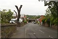
Pollarded tree, Birkdale Residential Home
Image: © Mark Anderson
Taken: 18 Jun 2019
0.13 miles
8
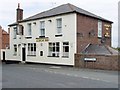
Albion Inn, St Georges
This is the largest remaining pub in St Georges and is situated beyond the west end of West St. It seems to be thriving where many of the town's pubs are struggling or have already given up.
Image: © Mike White
Taken: 13 Jun 2008
0.17 miles
9
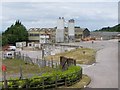
Oakengates Concrete Plant
A secluded sylvan setting for a works that has contributed to the building of Telford new town.
Image: © Mike White
Taken: 13 Jun 2008
0.20 miles
10
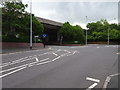
Oakengates Market Street railway station (site), Shropshire
Opened in 1861 by the London & North Western Railway on its line from Wellington to Coalport East, this station closed to passengers in 1952 and completely in 1964.
View south east from the former level crossing towards the station site, now buried under Queensway which was built on the course of the track but at a higher level. Just out of sight to the right, the former goods shed was still extant when this image was taken.
Image: © Nigel Thompson
Taken: 9 Jun 2019
0.21 miles