
IMAGES TAKEN NEAR TO
Brick Kiln Way, TELFORD, TF2 7RS
Introduction
This page details the photographs taken nearby to Brick Kiln Way, TF2 7RS by members of the Geograph project.
The Geograph project started in 2005 with the aim of publishing, organising and preserving representative images for every square kilometre of Great Britain, Ireland and the Isle of Man.

There are currently over 7.5m images from over14,400 individuals and you can help contribute to the project by visiting https://www.geograph.org.uk
Image Map
Images are licensed for reuse under creativecommons.org/licenses/by-sa/2.0
Notes
- Clicking on the map will re-center to the selected point.
- The higher the marker number, the further away the image location is from the centre of the postcode.
Image Listing (16 Images Found)
Images are licensed for reuse under creativecommons.org/licenses/by-sa/2.0
Image
Details
Distance
2
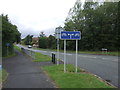
Cycle path beside Celandine Way, Donnington
Image: © JThomas
Taken: 10 Aug 2019
0.12 miles
3
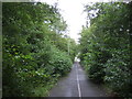
Cycle path, Donnington
Beside Donnington Wood Way.
Image: © JThomas
Taken: 10 Aug 2019
0.14 miles
4
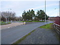
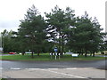
Donnington Wood roundabout
On the B5060, between Muxton and the main part of Donnington Wood.
Image: © Richard Law
Taken: 14 Jan 2017
0.15 miles
6
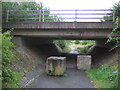
Cycle path towards Donnington Wood
Under a bridge on Donnington Wood Way.
Image: © JThomas
Taken: 10 Aug 2019
0.17 miles
7
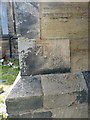
OS benchmark - Donnington, St Matthew's church
An OS cutmark on the east angle of the church seen in Image; originally levelled at 93.552m above Ordnance Datum Newlyn.
Image: © Richard Law
Taken: 25 Jul 2015
0.18 miles
8
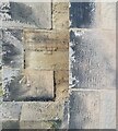
St Matthew's Benchmark
The Ordnance Survey benchmark cut into St Matthew's Church, Donnington Wood, Telford. The benchmark, last verified by the OS in 1961, is 0.8-metres off the ground and 93.55-metres above the Newlyn Datum. The Church was built between 1842 & 1844 for local colliery workers. It is Grade-II listed.
Image: © Anthony Rowley
Taken: 9 Sep 2021
0.18 miles
9
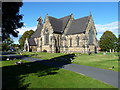
St Matthew's church, Donnington Wood
Taken on a much better day than my rather poorly-lit last effort Image, and highlighting the fact that this fine church, designed by G G Scott in 1843, attracted a Grade II listing https://britishlistedbuildings.co.uk/101054176-church-of-st-matthew-lilleshall-and-donnington#.W6uRKdQrLGg in 1983.
Image: © Richard Law
Taken: 26 Sep 2018
0.19 miles
10
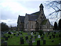
St Matthews, Donnington Wood
The church of St Matthew, the parish church for Donnington Wood, Donnington and The Humbers. It dates from 1845, during which time there have been colossal changes in the geography around it.
http://www.stmatthewsdonningtonwood.org.uk
Image: © Richard Law
Taken: 15 Jan 2011
0.19 miles