
IMAGES TAKEN NEAR TO
Buttery Grove, Church Parade, TELFORD, TF2 6NS
Introduction
This page details the photographs taken nearby to Buttery Grove, Church Parade, TF2 6NS by members of the Geograph project.
The Geograph project started in 2005 with the aim of publishing, organising and preserving representative images for every square kilometre of Great Britain, Ireland and the Isle of Man.

There are currently over 7.5m images from over14,400 individuals and you can help contribute to the project by visiting https://www.geograph.org.uk
Image Map
Images are licensed for reuse under creativecommons.org/licenses/by-sa/2.0
Notes
- Clicking on the map will re-center to the selected point.
- The higher the marker number, the further away the image location is from the centre of the postcode.
Image Listing (187 Images Found)
Images are licensed for reuse under creativecommons.org/licenses/by-sa/2.0
Image
Details
Distance
1
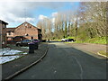
Buttery Grove in the Wombridge area of Telford
Image: © Richard Law
Taken: 10 Mar 2023
0.01 miles
2
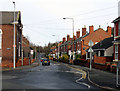
Stafford St. Oakengates, Telford
Looking North along Stafford St,Oakengates, this leads to Wrockwardine Wood and Donnington.
Image: © Gordon Cragg
Taken: 24 Jan 2009
0.06 miles
3
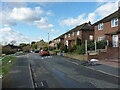
Withington Close, Wombridge
Housing from (probably) the late 1950s or early 1960s in the Wombridge area of Telford.
Image: © Richard Law
Taken: 10 Mar 2023
0.07 miles
4
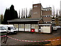
Oakengates Telephone Exchange, Telford
The exchange, identifier WNOAK, is on the east side of Church Parade in the Oakengates area of Telford.
Image: © Jaggery
Taken: 9 Nov 2015
0.07 miles
5
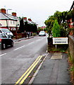
Wombridge boundary sign, Telford
Looking into the southern edge of the Wombridge area of Telford
from the northern edge of the Oakengates area. The road is Church Parade.
Image: © Jaggery
Taken: 9 Nov 2015
0.08 miles
7
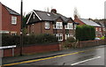
Leonard Street houses, Telford
Near the corner of Church Parade.
Image: © Jaggery
Taken: 9 Nov 2015
0.08 miles
8
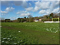
Recreation ground east of Wombridge
A large play area in the middle of extensive housing between the Oakengates and Wombridge areas of Telford.
Image: © Richard Law
Taken: 10 Mar 2023
0.09 miles
9

Mural, A442, Wrockwardine Wood
This decoration of the concrete wall of the dual carriageway depicts the geological formation of the East Shropshire Coalfield on which Telford is built. There was controversy over the cost, but I think it was worth it.
Image: © Mike White
Taken: 27 Sep 2008
0.09 miles
10
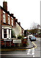
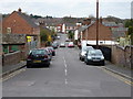
Oakengates boundary sign, Telford
Looking into the northern edge of the Oakengates area of Telford
from the southern edge of the Wombridge area.
The Telford Oakengates sign is on the corner of Leonard Street and New Street.
Image: © Jaggery
Taken: 9 Nov 2015
0.09 miles