
IMAGES TAKEN NEAR TO
Hartshill, TELFORD, TF2 6AN
Introduction
This page details the photographs taken nearby to Hartshill, TF2 6AN by members of the Geograph project.
The Geograph project started in 2005 with the aim of publishing, organising and preserving representative images for every square kilometre of Great Britain, Ireland and the Isle of Man.

There are currently over 7.5m images from over14,400 individuals and you can help contribute to the project by visiting https://www.geograph.org.uk
Image Map
Images are licensed for reuse under creativecommons.org/licenses/by-sa/2.0
Notes
- Clicking on the map will re-center to the selected point.
- The higher the marker number, the further away the image location is from the centre of the postcode.
Image Listing (138 Images Found)
Images are licensed for reuse under creativecommons.org/licenses/by-sa/2.0
Image
Details
Distance
1
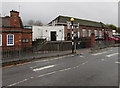
Steps up to Wombridge Primary School, Telford
Behind a Hartshill zebra crossing.
Image: © Jaggery
Taken: 9 Nov 2015
0.01 miles
2
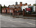
Wombridge Primary School nameboard, Telford
The school is on the south side of the road named Hartshill.
Image: © Jaggery
Taken: 9 Nov 2015
0.01 miles
3
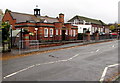
Wombridge Primary School, Telford
Viewed across Hartshill.
Image: © Jaggery
Taken: 9 Nov 2015
0.01 miles
4
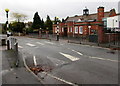
Zebra crossing on a hump, Hartshill, Oakengates, Telford
Across Hartshill outside Wombridge Primary School.
Image: © Jaggery
Taken: 9 Nov 2015
0.02 miles
5
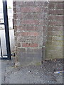
OS benchmark - Wombridge school
An OS cutmark on the gatepost of the Wombridge County Primary school; originally levelled at 124.861m above Ordnance Datum Newlyn.
Image: © Richard Law
Taken: 5 Jul 2014
0.03 miles
6
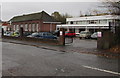
Vehicle-only entrance to Wombridge Primary School, Telford
From Hartshill. Notices on each side of the entrance show No pedestrian access.
Image: © Jaggery
Taken: 9 Nov 2015
0.03 miles
7
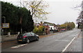
Humped zebra crossing sign, Hartshill, Oakengates, Telford
Alongside Hartshill on the approach to this http://www.geograph.org.uk/photo/4740819 zebra crossing.
Image: © Jaggery
Taken: 9 Nov 2015
0.03 miles
8
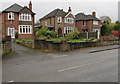
Three detached houses, Hartshill, Oakengates, Telford
Located between Hartshill Park and Wombridge Primary School.
Image: © Jaggery
Taken: 9 Nov 2015
0.04 miles
9
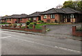
Hartshill bungalows, Telford
On the south side of Hartshill, between Wombridge Primary School http://www.geograph.org.uk/photo/4749298 and sports fields.
Image: © Jaggery
Taken: 9 Nov 2015
0.06 miles
10
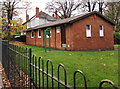
St John House, Hartshill, Oakengates, Telford
St John Ambulance building in Hartshill Park.
Image: © Jaggery
Taken: 9 Nov 2015
0.07 miles