
IMAGES TAKEN NEAR TO
Hadley Park Road, TELFORD, TF1 6QF
Introduction
This page details the photographs taken nearby to Hadley Park Road, TF1 6QF by members of the Geograph project.
The Geograph project started in 2005 with the aim of publishing, organising and preserving representative images for every square kilometre of Great Britain, Ireland and the Isle of Man.

There are currently over 7.5m images from over14,400 individuals and you can help contribute to the project by visiting https://www.geograph.org.uk
Image Map
Images are licensed for reuse under creativecommons.org/licenses/by-sa/2.0
Notes
- Clicking on the map will re-center to the selected point.
- The higher the marker number, the further away the image location is from the centre of the postcode.
Image Listing (5 Images Found)
Images are licensed for reuse under creativecommons.org/licenses/by-sa/2.0
Image
Details
Distance
1
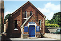
Leegomery Methodist Chapel
Built as a Primitive Methodist Chapel in 1878 and still going strong.
Image: © Gordon Cragg
Taken: Unknown
0.12 miles
2
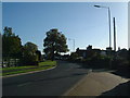
Hadley Park Road
The road takes you from the main A442 towards the centre of Hadley, through the Leegomery estate.
Image: © Steve McShane
Taken: 13 Nov 2005
0.21 miles
5
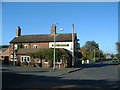
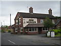
The Malt Shovel
The pub is on the outskirts of Leegomery in Telford. This photo also shows the old road that led out of the town, but a newer road has since been built out of shot to the right. The sign of a roundabout where this new road joins the A442 can be seen in the distance.
Image: © Steve McShane
Taken: 13 Nov 2005
0.24 miles