
IMAGES TAKEN NEAR TO
Campanula Grove, TF1 6BH
Introduction
This page details the photographs taken nearby to Campanula Grove, TF1 6BH by members of the Geograph project.
The Geograph project started in 2005 with the aim of publishing, organising and preserving representative images for every square kilometre of Great Britain, Ireland and the Isle of Man.

There are currently over 7.5m images from over14,400 individuals and you can help contribute to the project by visiting https://www.geograph.org.uk
Image Map
Images are licensed for reuse under creativecommons.org/licenses/by-sa/2.0
Notes
- Clicking on the map will re-center to the selected point.
- The higher the marker number, the further away the image location is from the centre of the postcode.
Image Listing (3 Images Found)
Images are licensed for reuse under creativecommons.org/licenses/by-sa/2.0
Image
Details
Distance
1
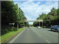
Footbridge over A5223, Whitchurch Drive
The bridge carries the Silkin Way, and links Dothill with Apley Castle Park
Image: © David Smith
Taken: 30 Sep 2016
0.16 miles
2
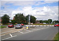
Shawbirch island
One of the main roundabouts on the north side of Telford - this one is rarely devoid of vehicles, being at the intersection of the A442 (Queensway) which carries traffic through the heart of the town, and the A5223 which comes directly from the M54 at Ketley.
Image: © Richard Law
Taken: 4 Aug 2012
0.21 miles
3
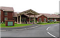
Severn Hospice, Telford
The main entrance to the Severn Hospice, Telford. Finally opened for residential patients in 2008, after many years of fund raising by many dedicated volunteers.http://www.severnhospice.org.uk/htm/telford.htm
Image: © Gordon Cragg
Taken: 25 May 2009
0.24 miles