
IMAGES TAKEN NEAR TO
Sinclair Gardens, TELFORD, TF1 5HR
Introduction
This page details the photographs taken nearby to Sinclair Gardens, TF1 5HR by members of the Geograph project.
The Geograph project started in 2005 with the aim of publishing, organising and preserving representative images for every square kilometre of Great Britain, Ireland and the Isle of Man.

There are currently over 7.5m images from over14,400 individuals and you can help contribute to the project by visiting https://www.geograph.org.uk
Image Map
Images are licensed for reuse under creativecommons.org/licenses/by-sa/2.0
Notes
- Clicking on the map will re-center to the selected point.
- The higher the marker number, the further away the image location is from the centre of the postcode.
Image Listing (11 Images Found)
Images are licensed for reuse under creativecommons.org/licenses/by-sa/2.0
Image
Details
Distance
2
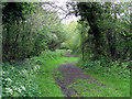
Old Railway Track
The track bed of the old GWR line at Ketley Town, this ran from Wellington to Craven Arms, via Much Wenlock. Further South, at Horsehay, part of this line is preserved by the Telford Steam Railway. http://www.telfordsteamrailway.co.uk/
Image: © Gordon Cragg
Taken: 5 May 2009
0.07 miles
3
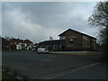
The Wren's Nest
Local boozer in Ketley.
Image: © Steve McShane
Taken: 15 Apr 2006
0.14 miles
4
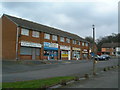
Local Shops
Local amenities for the people of Ketley.
Image: © Steve McShane
Taken: 15 Apr 2006
0.14 miles
5
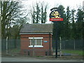
Water Pumping Station
The Wren's Nest is just to the right, and here's the sign to draw in the punters in front of a small water-pumping station. I wonder if anyone could see the irony in this photo?
Image: © Steve McShane
Taken: 15 Apr 2006
0.14 miles
6
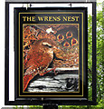
Wrens Nest, Inn Sign
A new Inn Sign for the Wrens Nest public house at Ketley Town. A great improvement on the former bland Banks's brewery sign.
Image: © Gordon Cragg
Taken: 5 May 2009
0.15 miles
7
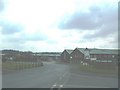
Ketley Business Park
Various factories and offices live here...
Image: © Steve McShane
Taken: 15 Apr 2006
0.17 miles
8
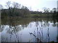
Parker's Pool, Ketley
A fishing pool run by the Glynwed Angling Club. Normally well known for good catches of roach, bream, tench and so on - today it was fishing badly, probably because of the recent cold temperatures and salty run-off from the motorway.
Image: © Richard Law
Taken: 24 Jan 2010
0.18 miles
9
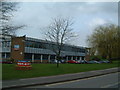
Read all about it...!
Here in Ketley is the home of the Shropshire Star, the county's biggest local newspaper.
Image: © Steve McShane
Taken: 15 Apr 2006
0.23 miles
10
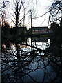
Pool at the back of houses on Morgan Way
A shallow pool at the rear of houses on Morgan Way, Ketley. There is a possibility (it's speculation on my part) that this may be the lower receiving pool for tub-boats at the bottom of the long-vanished Ketley Incline, whose location was just uphill of this point. It was used to bring tub-boats laden with coal and ore from the upper part of the Ketley Canal to a lower level, from where they moved to feed a foundry in Ketley Dingle. If this is so, then one likely contender for the route of the incline is the wooded bank shown in Image On the other hand, it could just be a random pond.
Image: © Richard Law
Taken: 1 Jan 2022
0.23 miles